Haswell, Colorado
| Town of Haswell, Colorado | |
|---|---|
| Statutory Town | |
 |
|
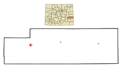
 Location in Kiowa County and the state of Colorado |
|
| Coordinates: 38°27′6″N 103°9′47″W / 38.45167°N 103.16306°WCoordinates: 38°27′6″N 103°9′47″W / 38.45167°N 103.16306°W | |
| Country |
|
| State |
|
| County | Kiowa County |
| Platted | 1908 |
| Incorporated | September 2, 1920 |
| Government | |
| • Type | Statutory Town |
| Area | |
| • Total | 0.8 sq mi (2.2 km2) |
| • Land | 0.8 sq mi (2.2 km2) |
| • Water | 0 sq mi (0 km2) |
| Elevation | 4,544 ft (1,385 m) |
| Population (2000) | |
| • Total | 84 |
| • Density | 105/sq mi (38.2/km2) |
| Time zone | MST (UTC-7) |
| • Summer (DST) | MDT (UTC-6) |
| ZIP code | 81045 |
| Area code(s) | 719 |
| FIPS code | 08-34740 |
| GNIS feature ID | 0195308 |
| Website | Town of Haswell |
|
|
|
The Town of Haswell is a Statutory Town located in Kiowa County, Colorado, United States. The town population was 84 at the 2000 census.
Haswell was established in 1905 or 1908, having grown up around one of the section houses built along the Missouri Pacific Railroad in eastern Colorado that were named after prominent men in alphabetical order from the Kansas State line to the west toward Pueblo, by Helen, daughter of railroad magnate Jay Gould, at the time of the railroad line's construction in 1888. It was incorporated in 1920.
Haswell is located at 38°27′6″N 103°9′47″W / 38.45167°N 103.16306°W (38.451774, -103.163116).
According to the United States Census Bureau, the town has a total area of 0.8 square miles (2.1 km2), all of it land.
As of the census of 2000, there were 84 people, 31 households, and 24 families residing in the town. The population density was 99.8 people per square mile (38.6/km²). There were 41 housing units at an average density of 48.7 per square mile (18.8/km²). The racial makeup of the town was 90.48% White, 2.38% African American, 5.95% Native American, and 1.19% from two or more races.
...
Wikipedia
