Harmony, Pennsylvania
| Harmony, Pennsylvania | |
| Borough | |
|
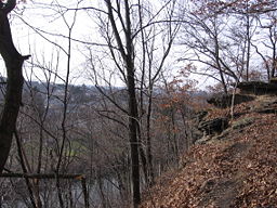
Rapp's Seat overlooking Harmony and Connoquenessing Creek
|
|
| Official name: Borough of Harmony | |
| Country | United States |
|---|---|
| State | Pennsylvania |
| County | Butler County |
| Township | Jackson Township |
| Coordinates | 40°48′10″N 80°7′40″W / 40.80278°N 80.12778°WCoordinates: 40°48′10″N 80°7′40″W / 40.80278°N 80.12778°W |
| Area | 1.04 km2 (0.4 sq mi) |
| - land | 1.02 km2 (0 sq mi) |
| - water | 0.01 km2 (0 sq mi) |
| Population | 890 (2010) |
| Density | 868.6/km2 (2,249.7/sq mi) |
| Settled | 1804 |
| - Incorporated | 1838 |
| Mayor | Cathy Rape |
| Timezone | EST (UTC-5) |
| - summer (DST) | EDT (UTC-4) |
| Zip Code | 16037 |
| Area code | 724 |
| School District | Seneca Valley school district |
|
Location of Harmony in Butler County
|
|
|
Website: www |
|
Harmony is a borough in Butler County, Pennsylvania, United States. The population was 890 at the 2010 census. It is located about 30 miles (48 km) north of Pittsburgh.
Harmony is located in southwest Butler County, along the northeast border of the borough of Zelienople. It is in the valley of Connoquenessing Creek, a tributary of the Beaver River.
Interstate 79 passes just east of the borough, with access from exits 87 and 88. Via I-79 it is 30 miles (48 km) south to downtown Pittsburgh and 99 miles (159 km) north to Erie. Pennsylvania Route 68 passes through the borough just south of the downtown and leads west into Zelienople and east 17 miles (27 km) to Butler, the county seat.
According to the United States Census Bureau, Harmony has a total area of 0.39 square miles (1.0 km2), of which 0.004 square miles (0.01 km2), or 1.23%, is water.
As of the census of 2000, there were 937 people, 409 households, and 267 families residing in the borough. The population density was 2,468.0 people per square mile (952.0/km²). There were 434 housing units at an average density of 1,143.1 per square mile (441.0/km²). The racial makeup of the borough was 99.15% White, 0.53% African American, 0.21% Native American, and 0.11% from two or more races. Hispanic or Latino of any race were 0.64% of the population.
...
Wikipedia


