Hargeysa
|
Hargeisa Hargeysa (Somali) هرجيسا (Arabic) |
|
|---|---|
| Capital | |
 |
|
| Location in Somaliland | |
| Coordinates: 9°33′47″N 44°4′3″E / 9.56306°N 44.06750°ECoordinates: 9°33′47″N 44°4′3″E / 9.56306°N 44.06750°E | |
| Country |
|
| Government | |
| • Mayor | Abdurrahman Mahmoud Aidiid |
| Area | |
| • Total | 33 km2 (13 sq mi) |
| Population (2017) | |
| • Total | 1,500,000 |
| • Density | 1,600/km2 (3,000/sq mi) |
| Time zone | EAT (UTC+3) |
| Area code(s) | +2563 |
| Website | hargeisamunicipality |
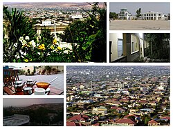
Hargeisa (Somali: Hargeysa, Arabic: هرجيسا) is a city situated in the Woqooyi Galbeed region of the self-declared but internationally unrecognised Republic of Somaliland in the Horn of Africa. It is the capital and largest city of the Somaliland.
During the Middle Ages, Hargeisa was part of the domain of the Adal Sultanate. The city later succeeded Berbera as the capital of the British Somaliland protectorate in 1941. In 1960, the protectorate gained independence and united as scheduled days later with the Trust Territory of Somaliland (the former Italian Somaliland) to form the Somali Republic (Somalia) on July 1.
Hargeisa is situated in a valley in the Galgodon (Ogo) highlands, and sits at an elevation of 1,334 m (4,377 ft). Home to rock art from the Neolithic period, the city is also a commercial hub for precious stone-cutting, construction, retail services and trading, among other activities.
Although little is known about the city's pre-19th century history,Encyclopaedia Aethiopica suggests that the settlement may have evolved in the latter half of the 1800s as a Qadiriyya settlement established by Shaykh Maddar, near a water-stop used by nomadic stock-herders on the way to the town of Harar. It thus proposes that the name "Hargeisa" was possibly derived from the sobriquet Harar as-sagir, meaning "Harar the little" or simply "little Harar'"
Numerous cave paintings from the Neolithic period are found in the Laas Geel complex, on the outskirts of Hargeisa. During November and December 2002, an archaeological survey was carried out in the area by a French team of researchers. The expedition's objective was to search for rock shelters and caves containing stratified archaeological infills capable of documenting the period when production economy appeared in this part of Somaliland (circa 5th and 2nd millennium BCE). During the course of the survey, the French archaeological team discovered the Laas Geel rock art, encompassing an area of ten rock alcoves (caves). In an excellent state of preservation, the paintings show human figures with their hands raised and facing long-horned, humpless cattle.
...
Wikipedia

