Hanover Township, Northampton County, Pennsylvania
| Hanover Township | |
| Settlement | |
|
Schortz Old School House (1871) on Jacksonville Rd.
|
|
| Country | United States |
|---|---|
| State | Pennsylvania |
| County | Northampton |
| Elevation | 390 ft (118.9 m) |
| Coordinates | 40°41′00″N 75°22′59″W / 40.68333°N 75.38306°WCoordinates: 40°41′00″N 75°22′59″W / 40.68333°N 75.38306°W |
| Area | 6.7 sq mi (17.4 km2) |
| - land | 6.7 sq mi (17 km2) |
| - water | 0.0 sq mi (0 km2), 0% |
| Population | 10,866 (2010) |
| Density | 1,621.8/sq mi (626.2/km2) |
| Timezone | EST (UTC-5) |
| - summer (DST) | EDT (UTC-4) |
| Area code | 610 |
|
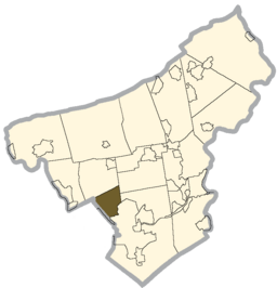
Location of Hanover Township in Northampton County
|
|
|
Website: www |
|
Hanover Township is a township in Northampton County, Pennsylvania, United States. Hanover Township is located in the Lehigh Valley region of the state.
The population of Hanover Township was 10,866 at the 2010 census.
According to the United States Census Bureau, the township has a total area of 6.7 square miles (17 km2), all of it land. It is drained by Monocacy Creek and Catasauqua Creek into the Lehigh River. Its villages include Hanoverville, Schoenersville (pronounced "SHAY-nerz-vil" and also in Lehigh County), Stoke Park, and Westgate Hills. Its numbered roads include the east-to-west Highway 22 and north-to-south Routes 512 and 987, which connect Bath with Bethlehem and Allentown as Bath Pike and Airport Road, respectively. Other local roads of note include east-to-west Hanoverville Road, Macada Road, and Stoke Park Road and north-to-south Jacksonville Road and Township Line Road. Hanover Township is a suburb of the city of Bethlehem which lies just to the north of the city. Officially has never been considered as a section of the city of Bethlehem, rather just a neighboring community with a strong connection to its large municipal neighbor to the south.
As of the census of 2010, there were 10,866 people, 4,245 households, and 3,144 families residing in the township. The population density was 1,634.9 people per square mile (631.0/km2). There were 4,245 housing units at an average density of 638.7/sq mi (250.0/km2). The racial makeup of the township was 87.12% White, 2.74% African American, 0.05% Native American, 6.53% Asian, 1.44% from other races, and 2.12% from two or more races. Hispanic or Latino of any race were 4.83% of the population.
...
Wikipedia


