Ham, London, England
| Ham | |
|---|---|
 Ham House in 2007 |
|
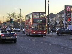
 Housing by Ham Parade |
|
| Ham shown within Greater London | |
| Area | 9.26 km2 (3.58 sq mi) |
| Population | 10,317 (Ham Petersham and Richmond Riverside wards 2011) |
| • Density | 1,114/km2 (2,890/sq mi) |
| OS grid reference | TQ1772 |
| London borough | |
| Ceremonial county | Greater London |
| Region | |
| Country | England |
| Sovereign state | United Kingdom |
| Post town | RICHMOND |
| Postcode district | TW10 |
| Dialling code | 020 |
| Police | Metropolitan |
| Fire | London |
| Ambulance | London |
| EU Parliament | London |
| UK Parliament | |
| London Assembly | |
Ham is a suburban district in south-west London which has meadows adjoining the River Thames where the Thames Path National Trail also runs. Most of Ham is in the London Borough of Richmond upon Thames and, chiefly, within the ward of Ham, Petersham and Richmond Riverside; the rest is in the Royal Borough of Kingston upon Thames. The district has modest convenience shops and amenities, including a petrol station and several pubs, but its commerce is subsidiary to the nearby regional-level economic centre of Kingston upon Thames.
Ham is centred 9.25 miles (14.89 km) south-west of the centre of London. Together with Petersham, Ham lies east of the bend in the river almost surrounding it on three sides, 1 mile (1.6 km) south of Richmond and 2 miles (3.2 km) north of Kingston upon Thames. Its elevation mostly ranges between 6m and 12m OD but reaches 20m in the foothill side-streets leading to Richmond Park. It has the Thames Path National Trail and is connected to Teddington by a large Lock Footbridge at Teddington Lock, and during the summer months Hammerton's Ferry a pedestrian ferry links it to Marble Hill House, Twickenham.
...
Wikipedia

