Hafslo
| Hafslo herad | |
|---|---|
| Former Municipality | |
 |
|
| Location in Sogn og Fjordane county | |
| Coordinates: 61°18′39″N 07°11′08″E / 61.31083°N 7.18556°ECoordinates: 61°18′39″N 07°11′08″E / 61.31083°N 7.18556°E | |
| Country | Norway |
| Region | Western Norway |
| County | Sogn og Fjordane |
| District | Sogn |
| Municipality ID | NO-1425 |
| Admin. Center | Hafslo |
| Demonym(s) | Hafslobygding |
| Time zone | CET (UTC+01:00) |
| • Summer (DST) | CEST (UTC+02:00) |
| Created as | Formannskapsdistrikt in 1838 |
| Merged into | Luster in 1963 |
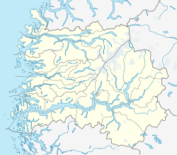
Hafslo is a former municipality in Sogn og Fjordane county, Norway. It is located in the present-day municipality of Luster in the traditional district of Sogn. The former municipality included the villages of Kinsedalen, Ornes, and Kroken on the east side of the Lustrafjorden. It also included the villages of Solvorn, Hafslo, Joranger, and the whole Veitastrond valley on the west side of the Lustrafjorden. The municipality surrounded the lakes Hafslovatnet and Veitastrondvatnet. The administrative centre of the municipality was the village of Hafslo, where Hafslo Church was located.
The name comes from the old Hafslo farm (Old Norse: Hafrsló), since Hafslo Church is located there. The first element of the name comes from the old male name Hafr or from the word for "goat" (also hafr). The second element of the name comes from the old word ló meaning "meadow, probably due to the excellent farming areas nearby.
Hafslo was established as a municipality on 1 January 1838 (see formannskapsdistrikt). On 1 January 1963, Hafslo was merged with the neighboring municipalities of Luster and Jostedal to form the new, larger municipality of Luster. Prior to the merger, Hafslo had a population of 2,384.
The Hafslo village area in the central part of the municipality
...
Wikipedia

