Gwynns Falls Trail
| Gwynns Falls Trail | |
|---|---|

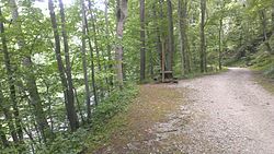
Westbound, approaching the Windsor Mill Road trailhead
|
|
| Established | 1999 |
| Length | 15 mi (24 km) |
| Location | Gwynns Falls Leakin Park, Baltimore, Maryland, United States |
| Trailheads |
Harbor Hospital |
| Use | Bicycling, hiking, fishing, rollerblading, bird-watching |
| Hiking details | |
| Season | Year-round |
| Months | Year-round |
| Surface | Asphalt, concrete, crushed gravel |
| Website | http://www.gwynnsfallstrail.org/ |
Harbor Hospital
Waterview Avenue
Inner Harbor/Visitors Center
Carrollton Park Golf Course
Frederick Avenue
Leon Day Park
Windsor Mill Road
Leakin Park/Winans Meadow
Gywnns Falls Trail is a 15-mile (24 km) series of hiking and bicycling trails inside Baltimore, Maryland, named for the Gwynns Falls, whose course it follows, and the surrounding Gwynns Falls Leakin Park it passes through. The trail uses unique alignments, sidepaths on existing streets, and on-street sections. The trail consists of one 10.75-mile (17.30 km) mainline, plus a number of branches, including the Middle Branch Trail, the Hutton Trail, and the Dickeyville Trail. All of these trails carry signage designating them as the Gwynns Falls Trail; their individual names are designated via pavement markers designating their route. The entirety of the Middle Branch Trail, as well as the section of the mainline trail east of the Middle Branch Trail's northern terminus, are part of the East Coast Greenway.
Established in 1998, Gwynns Falls Trail currently operates as a public-private partnership: it is owned and managed by the City of Baltimore, while the Parks & People Foundation coordinates community involvement, volunteer activities and events along the trail.
The Gwynns Falls Trail mainline (abbreviated "GF") runs 10.75 miles (17.30 km) from Baltimore's Inner Harbor to the Park and Ride facility at the end of Interstate 70, located at the park boundary at the city/county border. The zero mile of the Gwynns Falls Trail mainline is along a sidepath to the east of Light Street, at the Conway Street intersection. Here, the Gwynns Falls Trail encounters the Jones Falls Trail, which travels north on Light Street on the sidepath to eventually enter the Jones Falls valley. At this point, the Gwynns Falls Trail is a part of the East Coast Greenway, as is the Jones Falls Trail, which continues north.
The Gwynns Falls Trail travels south one mile to the Lee Street intersection, where it splits for its two directions due to the presence of one-way streets. The westbound trail leaves the sidepath and goes east onto Lee Street, then turns south onto Sharp Street to recombine with its opposing direction at the Henrietta Street intersection. The eastbound trail travels east along Henrietta Street, turning south onto Light Street, then immediately east again onto Warren Street. It then turns north on William Street and crosses Key Highway to take the aforementioned sidepath.
...
Wikipedia
