Gunzgen
| Gunzgen | ||
|---|---|---|

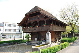
Gunzgen village
|
||
|
||
| Coordinates: 47°19′N 7°50′E / 47.317°N 7.833°ECoordinates: 47°19′N 7°50′E / 47.317°N 7.833°E | ||
| Country | Switzerland | |
| Canton | Solothurn | |
| District | Olten | |
| Area | ||
| • Total | 3.94 km2 (1.52 sq mi) | |
| Elevation | 429 m (1,407 ft) | |
| Population (Dec 2015) | ||
| • Total | 1,655 | |
| • Density | 420/km2 (1,100/sq mi) | |
| Postal code | 4617 | |
| SFOS number | 2578 | |
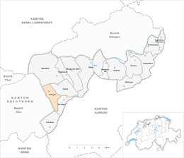
| Surrounded by | Boningen, Egerkingen, Fulenbach, Hägendorf, Härkingen, Kappel | |
| Website |
www SFSO statistics |
|
Gunzgen is a municipality in the district of Olten in the canton of Solothurn in Switzerland.
Gunzgen is first mentioned in 1226 as Gunzichon. In 1320 it was mentioned as Gunzkon.
Gunzgen has an area, as of 2009[update], of 3.94 square kilometers (1.52 sq mi). Of this area, 1.82 km2 (0.70 sq mi) or 46.2% is used for agricultural purposes, while 0.97 km2 (0.37 sq mi) or 24.6% is forested. Of the rest of the land, 1.08 km2 (0.42 sq mi) or 27.4% is settled (buildings or roads), 0.03 km2 (7.4 acres) or 0.8% is either rivers or lakes and 0.01 km2 (2.5 acres) or 0.3% is unproductive land.
Of the built up area, industrial buildings made up 6.3% of the total area while housing and buildings made up 7.9% and transportation infrastructure made up 7.6%. Power and water infrastructure as well as other special developed areas made up 5.3% of the area Out of the forested land, all of the forested land area is covered with heavy forests. Of the agricultural land, 32.2% is used for growing crops and 11.7% is pastures, while 2.3% is used for orchards or vine crops. Of the water in the municipality, 0.3% is in lakes and 0.5% is in rivers and streams.
The municipality is located in the Olten district, in the Mittelgäu along the Dünnern river. The municipal borders changed during the Dünnern River Correction in 1933-43. It consists of the linear village of Gunzgen and the settlement of Allmend which is separated from the main village by the A1 and A2 motorways.
The blazon of the municipal coat of arms is Per fess Argent an Oak issuant leaved and acorned Vert and Azure a Mill Wheel Or.
Gunzgen has a population (as of December 2015[update]) of 1,655. As of 2008[update], 9.6% of the population are resident foreign nationals. Over the last 10 years (1999–2009 ) the population has changed at a rate of 13.8%.
...
Wikipedia


