Guildown
| Hog's Back | |
|---|---|

The Hog's Back seen from the North Downs Way at Puttenham.
|
|
| Highest point | |
| Elevation | 154 m (505 ft) |
| Coordinates | 51°13′36″N 0°38′36″W / 51.22667°N 0.64333°WCoordinates: 51°13′36″N 0°38′36″W / 51.22667°N 0.64333°W |
| Geography | |
| Parent range | North Downs |
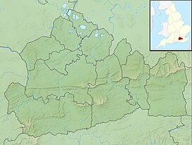
The Hog's Back is a part of the North Downs in Surrey, England, that lies between Farnham in the west and Guildford in the east.
Compared with the main part of the Downs to the east of it, it is a narrow elongated ridge, hence its name.
Jane Austen, in a letter to her sister Cassandra dated Thursday 20 May 1813 from her brother's house in Sloane Street, wrote of her journey to London in a curricle via "the Hog's-back" and said
This shows that it was known as the Hog's Back by Jane Austen's time. However, the medieval name for the ridge was Guildown (recorded first in 1035 where it was the site of the abduction of Prince Alfred of Wessex by Earl Godwin and then in the Pipe Rolls for 1190 and onwards) but this name is no longer in use. However, the name Guildown is evoked by Guildown Road, a residential road which climbs the southern side of the ridge on the southwestern fringes of Guildford.
The Guild- element of Guildown is the same as that found in Guildford, meaning "gold". Various explanations have been suggested for the relationship between the names of Guildown and Guildford. Guildown may be an abbreviation of Guildford Down ("the Down by Guildford"). Guildford is the point where the River Wey cuts through the Hog's Back. Alternatively, both Guildown and Guildford may derive independently from a gold-coloured feature; either the yellow flowers of the marsh marigold or the gold-coloured (sandy) soil of the hillside, Guildford translates literally as gold ford after the golden coloured sandy soil at the Ford in the River Wey.
The Hog's Back has a minimum prominence (drop) of 55 metres (180 ft), reaching 154 m (505 ft) above sea level, the 24th highest hill in Surrey.
Along its course are half panoramas north and south separated by less than 100 m (330 ft) viewable from paths alongside the road which runs along the Hog's Back (the A31).
The view north includes many towns and villages, including Ash and Aldershot which on a clear day reaches to London, as far as Canary Wharf, Tower 42, The Gherkin, Wembley Arch and Heathrow Airport. The view to the south is unspoilt and has been designated an area of outstanding natural beauty as well as a site of special scientific interest. These views extend to Hindhead and the Devil's Punchbowl.
...
Wikipedia

