Gualaceo
| Santiago de Gualaceo | |||
|---|---|---|---|
| Canton | |||
 |
|||
|
|||
| Motto: Justo Y Fuerte | |||
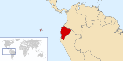
 Location Ecuador |
|||
 Location Gualaceo |
|||
| Coordinates: 2°54′0″S 78°47′0″W / 2.90000°S 78.78333°WCoordinates: 2°54′0″S 78°47′0″W / 2.90000°S 78.78333°W | |||
| Country | Ecuador | ||
| Province | Azuay | ||
| Parishes | Gualaceo San Juan Mariano Moreno Remigio Crespo Luis Cordero Jadan Zhidmad |
||
| Settled | 1534 | ||
| Canton | June 25, 1824 | ||
| Government | |||
| • Mayor | Marco Tapia | ||
| Elevation | 2,449 m (8,032 ft) | ||
| Time zone | GMT-5:00 (Quito, Bogota, Lima) (UTC-5) | ||
| Website | www.gualaceo.gob.ec | ||
Gualaceo /ɡwələˈsiː.oʊ/, nicknamed "El Jardin Del Azuay" (The Garden of Azuay), is a canton (territorial subdivision) in the south-central region of Ecuador. It belongs to Azuay Province, Ecuador. Its population is 42.000 inhabitants according to the official website visitagualaceo.com.
The origin of its name is debatable. Some historians affirm that the name comes from the Chibcha word “gualaca” meaning macaw’s settlement, while others state that it was named after a mythological Cañari Indian named Gualaco or Gualaca, but both coincide in its meaning “macaw’s settlement”.
Ethnic groups as of the Ecuadorian census of 2010:
Gualaceo is a sizable town located in a valley in the southeast of the Ecuadorian Andes cordillera, and about 20 miles east of the province capital Cuenca; its altitude is 2.449 meters. The valley of Gualaceo is crossed by the Santa Barbara River and its 3 smaller tributaries the San Francisco, San Jose y Guaymincay, creating a beautiful riverfront scenery; their waters are still clean enough that swimmers can be observed virtually every day.
...
Wikipedia


