Grossaffoltern
| Grossaffoltern | ||
|---|---|---|
|
||
| Coordinates: 47°4′N 7°21′E / 47.067°N 7.350°ECoordinates: 47°4′N 7°21′E / 47.067°N 7.350°E | ||
| Country | Switzerland | |
| Canton | Bern | |
| District | Seeland | |
| Area | ||
| • Total | 15.03 km2 (5.80 sq mi) | |
| Elevation | 511 m (1,677 ft) | |
| Population (Dec 2015) | ||
| • Total | 2,999 | |
| • Density | 200/km2 (520/sq mi) | |
| Postal code | 3257 | |
| SFOS number | 0303 | |
| Localities | Ammerzwil, Kaltenbrunnen, Kosthofen, Ottiswil, Suberg, Vorimholz, Weingarten | |
| Surrounded by | Diessbach bei Büren, Lyss, Rapperswil, Schüpfen, Seedorf, Wengi | |
| Twin towns | Horsovsky Tyn (Czech Republic) | |
| Website |
www SFSO statistics |
|
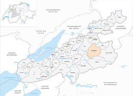
Grossaffoltern is a municipality in the Seeland administrative district in the canton of Bern in Switzerland. It is known for its stork colony.
Grossaffoltern is first mentioned in 1216 as Affoltron.
The oldest evidence of humans in the Grossaffoltern area are neolithic objects at Vorimholz, an Early Bronze Age ax blade depot at Munimatte and Bronze Age items at Kosthofen. There are at least 38 Hallstatt era grave mounds scattered around the municipality. The area was also inhabited during the Roman era and the Early Middle Ages. During the Middle Ages it was owned by the House of Zähringen until that family died out, when it was inherited by the Kyburgs. Under the Zähringens and the Kyburgs, during the 13th and 14th centuries, it was part of the district of Oltigen. In 1412, Grossaffoltern and the surrounding villages came under Bernese control. It was originally part of the bailiwick of Oltigen until that was dissolved in 1483, when it became part of the bailiwick of Aarberg allocated. Under the Helvetic Republic, in 1798, Grossaffoltern was in the Zollikofen district before switching back to the Aarberg district in 1803.
The village church of St. Stephen was first mentioned in 1275. The current church building is from 1510–24, though it was built on top of the foundations of two 12th or 13th century churches. The church tower is from the 14th century. In 1383 it was given by Anna of Kyburg-Nidau to the monastery of Klingental near Basel. The monastery sold the church in 1416 to the Abbey of Frienisberg. Under Frienisberg it became the parish church of the local parish in 1451. The parish came under Bernese control in 1528.
...
Wikipedia


