Great Republic of Rough and Ready
| Rough and Ready | |
|---|---|
| census-designated place | |

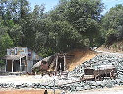
A scene in Rough and Ready near the Historic Toll House
|
|
| Location within the state of California | |
| Coordinates: 39°13′49″N 121°8′6″W / 39.23028°N 121.13500°WCoordinates: 39°13′49″N 121°8′6″W / 39.23028°N 121.13500°W | |
| Country | United States |
| State | California |
| County | Nevada |
| Area | |
| • Total | 3.170 sq mi (8.210 km2) |
| • Land | 3.170 sq mi (8.210 km2) |
| • Water | 0 sq mi (0 km2) 0% |
| Population (2010) | |
| • Total | 963 |
| • Density | 300/sq mi (120/km2) |
| Time zone | Pacific (PST) (UTC-8) |
| • Summer (DST) | PDT (UTC-7) |
| ZIP codes | 95975 |
| Area code(s) | 530 |
| GNIS feature ID | 2628785 |
|
U.S. Geological Survey Geographic Names Information System: Rough and Ready, California |
|
| Official name | Little Town of Rough and Ready |
| Reference no. | 294 |
U.S. Geological Survey Geographic Names Information System: Rough and Ready, California
Rough and Ready is a census-designated place in Nevada County, California, United States. It is located west of Grass Valley, California, approximately 62 miles (100 km) from Sacramento. The population was 963 at the 2010 census. It has frequently been noted on lists of unusual place names.
The first established settlement in Rough and Ready was made in the fall of 1849 by a mining company from Wisconsin, known as the Rough and Ready Company, during the California Gold Rush. Their leader, Captain A. A. Townsend, named the company after General Zachary Taylor (nicknamed "Old Rough and Ready") who had recently been elected the 12th President of the United States. Captain Townsend had served under Taylor when he commanded the American Forces during the U.S.-Mexican War. California had three towns so named of which this one survives.
The town declared its secession from the Union as "the Great Republic of Rough and Ready" in 1850, largely to avoid mining taxes, but voted to rejoin the Union the following year. The old republic is celebrated annually as a way to attract tourism.
The post office at Rough and Ready was established by February 1851; the first postmaster was Marcus Nutting. The ZIP Code is 95975. The community is inside area code 530.
The post office was closed for a time in 1855, again for a time in 1913, and again from 1942 to 1948.
What little is left of the town is located on the Rough and Ready Highway. It was bypassed by State Route 20 in the mid 1980s. Among the oldest buildings are the blacksmith shop (1850s), the Odd Fellows Hall (1854), and the Old Toll House.
...
Wikipedia

