Grächen
| Grächen | ||
|---|---|---|
 |
||
|
||
| Coordinates: 46°10′N 7°49′E / 46.167°N 7.817°ECoordinates: 46°10′N 7°49′E / 46.167°N 7.817°E | ||
| Country | Switzerland | |
| Canton | Valais | |
| District | Visp | |
| Government | ||
| • Mayor | Jakob Walter | |
| Area | ||
| • Total | 14.32 km2 (5.53 sq mi) | |
| Elevation | 1,619 m (5,312 ft) | |
| Population (Dec 2015) | ||
| • Total | 1,351 | |
| • Density | 94/km2 (240/sq mi) | |
| Postal code | 3925 | |
| SFOS number | 6285 | |
| Surrounded by | Eisten, Embd, Sankt Niklaus, Stalden, Törbel | |
| Website |
www SFSO statistics |
|
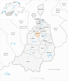
Grächen is a municipality in the district of Visp in the canton of Valais in Switzerland.
The village is situated at an altitude of 1,620 meters (5,310 ft) on a terrace above St. Niklaus in the Mattertal, north of the Mischabel range (and Dom).
Settlements in the area of Grächen probably date back to neolithic times. It certainly was a hunting ground for early Bronze Age alpine people(celts List of Celts). Around 750 (CE), the Alamanni started to settle in the upper (German-speaking) part of what is now the canton of Valais.
Grächen is first mentioned in 1210 as de Grachan. In 1250 it was mentioned as de Granges. Grächen developed into a community of farmers in servitude and paying tribute to various feudal lords, until they finally reached their independence as a community (from the Bishop of Sion) in the 19th century.
Thomas Platter, a famous citizen of 16th century Grächen, published his autobiography describing a life from humble beginnings as a goatherd to a fulfilled existence as lord of a manor, master of herbal lore, publisher and school director. His son Felix Platter became a famous medical doctor and anatomist.
Grächen has an area, as of 2011[update], of 14.3 square kilometers (5.5 sq mi). Of this area, 13.7% is used for agricultural purposes, while 53.7% is forested. Of the rest of the land, 5.1% is settled (buildings or roads) and 27.5% is unproductive land.
The municipality is located in the Visp district, on a terrace below the Ried Glacier. The glacier extends about 5 km (3.1 mi) from Ried to Bärgji and is about 1 km (0.62 mi).
...
Wikipedia


