Goulds, Florida
| Goulds, Florida | |
|---|---|
| CDP | |
 Location in Miami-Dade County and the state of Florida |
|
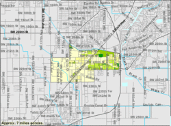
 U.S. Census Bureau map showing CDP boundaries |
|
| Coordinates: 25°33′39″N 80°23′0″W / 25.56083°N 80.38333°WCoordinates: 25°33′39″N 80°23′0″W / 25.56083°N 80.38333°W | |
| Country |
|
| State |
|
| County | Miami-Dade |
| Area | |
| • Total | 3 sq mi (7.7 km2) |
| • Land | 3 sq mi (7.7 km2) |
| • Water | 0 sq mi (0 km2) |
| Elevation | 10 ft (3 m) |
| Population (2010) | |
| • Total | 10,103 |
| • Density | 3,367.7/sq mi (1,300.3/km2) |
| Time zone | Eastern (EST) (UTC-5) |
| • Summer (DST) | EDT (UTC-4) |
| ZIP code | 33170 |
| Area code(s) | 305 |
| FIPS code | 12-26950 |
| GNIS feature ID | 0283239 |
Goulds is a census-designated place (CDP) in Miami-Dade County, within the U.S. state of Florida. The area was originally populated as the result of a stop on the Florida East Coast Railroad. The railroad depot was located near the current Southwest 216th Street. The community was named after its operator, Lyman Gould, who cut trees for railroad ties. As of the 2009 census, the population stood at 10,103.
Goulds is located at 25°33′39″N 80°23′0″W / 25.56083°N 80.38333°W (25.560885, -80.383353). According to the United States Census Bureau, the CDP has a total area of 3.0 square miles (7.8 km2), all of it land. Cauley Square Historic Village is notably located in Goulds.
The area that became Goulds was settled in 1900 by homesteaders. It received its name when the Florida East Coast Railway built a siding in 1903, operated by an employee of the railroad named Lyman Goulds. It was first known as Gould's Siding, and later shortened to Goulds. Many packing houses were built along Old Dixie Highway. Early on, Goulds had a reputation as a rough town and a hub of mischief, however the town was terribly damaged in the 1926 Miami Hurricane. Today, Goulds is now a small community of mainly poor African-Americans, sharing borders with the neighboring communities of South Miami Heights, Cutler Bay, Quail Heights, Redland, and Princeton.
...
Wikipedia
