Glendoe Hydro Scheme
| Glendoe Reservoir | |
|---|---|
 |
|
|
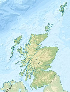
Location of Glendoe Reservoir in UK Scotland
|
|
| Official name | Glendoe Hydro Scheme |
| Country | United Kingdom |
| Location | Highlands |
| Coordinates | 57°05′35″N 4°33′22″W / 57.093°N 4.556°WCoordinates: 57°05′35″N 4°33′22″W / 57.093°N 4.556°W |
| Opening date | 29 June 2009 |
| Owner(s) | Scottish and Southern Energy |
| Dam and spillways | |
| Height | 35 m |
| Length | 905 m |
| Reservoir | |
| Catchment area | 15 km² (immediate) 60 km² (artificial) |
| Maximum length | 2 km |
| Normal elevation | 630 m |
| Power station | |
| Installed capacity | 100 MW (max. planned) |
The Glendoe Hydro Scheme for the generation of hydro-electric power is located near Fort Augustus, above Loch Ness in the Highlands of Scotland.
The scheme is operated by Scottish and Southern Energy (SSE) and was opened on 29 June 2009 by Her Majesty Queen Elizabeth, accompanied by HRH The Duke of Edinburgh.
Glendoe's 600 m head (the drop from the reservoir to the turbine) is the highest of any hydro electric scheme in the United Kingdom, and is thus ideally suited to generating large amounts of energy from the stored water in the reservoir, especially when combined with the relatively high annual rainfall in the area of around 2,000 mm. The Andritz six-jet vertical axis Pelton turbine at Glendoe is capable of generating up to 100 MW, with a peak flow of 18.6m³/s.
It is the largest of Scotland's recent civil engineering projects, with Hochtief as the design and build contractor. The scheme is predicted to produce about 180 GWh of electricity per year, enough to provide approximately 5% of the electricity consumption of the city of Glasgow. This gives an overall load factor of approximately 20%.
The immediate catchment of 15 km² is supplemented by a further 60 km² connected to the scheme by an underground network of pipes and tunnels, and this is fed into the reservoir on the upper reaches of the River Tarff. The dam, a 905-metre-long concrete-faced rock-filled embankment reaching a height of 35 metres above the valley floor, is hidden from view from all current houses and public roads in the area.
...
Wikipedia

