Gila National Forest
| Gila National Forest | |
|---|---|
|
IUCN category VI (protected area with sustainable use of natural resources)
|
|

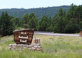
Gila National Forest along New Mexico Route 180
|
|
| Location | New Mexico, United States |
| Nearest city | Silver City, NM |
| Coordinates | 33°28′N 108°32′W / 33.47°N 108.53°WCoordinates: 33°28′N 108°32′W / 33.47°N 108.53°W |
| Area | 2,710,659 acres (10,969.65 km2) |
| Established | July 21, 1905 |
| Governing body | U.S. Forest Service |
| Website | Gila National Forest |
The Gila National Forest is a protected national forest in New Mexico in the southwestern part of the United States established in 1905. It covers approximately 2,710,659 acres (1,096,965 ha) of public land, making it the sixth largest National Forest in the continental United States. The Forest also manages that part of the Apache National Forest that is in New Mexico which totals an additional 614,202 acres for a total of 3.3 million acres managed by the Gila National Forest. Part of the forest, the Gila Wilderness, was established in 1924 as the first designated wilderness reservation by the U.S. federal government. Aldo Leopold Wilderness and the Blue Range Wilderness are also found within its borders. (The Blue Range Primitive Area lies within Arizona in the neighboring Apache National Forest.)
The forest lies in southern Catron, northern Grant, western Sierra, and extreme northeastern Hidalgo counties in southwestern New Mexico. Forest headquarters are located in Silver City, New Mexico. There are local ranger district offices in Glenwood, Mimbres, Quemado, Reserve, Silver City, and Truth or Consequences. The Gila Cliff Dwellings National Monument is located with the Catron County section of the forest.
...
Wikipedia

