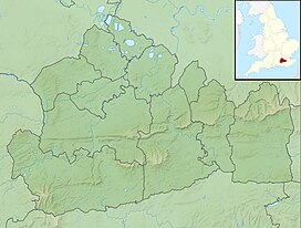
Gibbet Hill, Hindhead
| Gibbet Hill | |
|---|---|

The Celtic Cross
|
|
| Highest point | |
| Elevation | 272 m (892 ft) |
| Coordinates | 51°06′58″N 0°42′58″W / 51.11611°N 0.71611°WCoordinates: 51°06′58″N 0°42′58″W / 51.11611°N 0.71611°W |
| Geography | |
| Parent range | Greensand Ridge |
Gibbet Hill, at Hindhead, Surrey, is the apex of the scarp surrounding the Devil's Punch Bowl, not far from the A3 London to Portsmouth road in England.
Gibbet Hill stands 272 metres (892 ft) above sea level. It is the second highest hill in Surrey. Leith Hill stands 23 metres taller and Botley Hill stands 2.4 metres lower.
It commands a panoramic view, especially to the north and east. The view to the north overlooks the Devil's Punchbowl, Thursley, Hankley Common, Crooksbury Hill, and the Hog's Back towards Godalming and Guildford. To the east lies the Sussex Weald. To the south, the hills of Haslemere and Blackdown can be seen, with some sections of the South Downs. On a clear day it is possible to see tallest buildings in London's skyline including The Gherkin, Tower 42 and Wembley Stadium, approximately 61 kilometres (38 mi) away as well as intermediate landmarks such as towers in Woking and Guildford Cathedral.
Weydown common lies to the south of Gibbet Hill. From 1909 or earlier until 1939 or later, a white horse was carved into the hillside at Combe Head, so that it could be seen from Gibbet Hill, although the figure is now covered by heath.
The area was one of disrepute due to the activities of highwaymen and robbers, the corpses of three of whom were formerly displayed there on a gibbet as punishment for their crimes. Another account has the cross as Erle's unmarked memorial erected after his death.
...
Wikipedia

