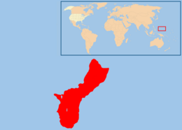
Geography of Guam
| Native name: Guåhån | |
|---|---|

Map of Guam (See detailed map)
|
|
| Geography | |
| Location | Pacific Ocean |
| Coordinates | 13°26′31″N 144°46′35″E / 13.44194°N 144.77639°ECoordinates: 13°26′31″N 144°46′35″E / 13.44194°N 144.77639°E |
| Archipelago | Mariana Islands |
| Area | 544 km2 (210 sq mi) |
| Length | 51 km (31.7 mi) |
| Width | 15 km (9.3 mi) |
| Highest elevation | 406 m (1,332 ft) |
| Highest point | Mount Lamlam |
| Administration | |
| Territory | Guam |
| Largest settlement | Dededo (pop. 46,000) |
| Demographics | |
| Population | 173,456 (2007) |
| Pop. density | 320.44 /km2 (829.94 /sq mi) |
| Ethnic groups | Native Chamorros (57%), Filipino (25.5%), White (10%), Chinese, Japanese and Korean ancestry |
This article describes the geography of the United States territory of Guam.
This is a list of the extreme points of Guam, the points that are farther north, south, east or west than any other location.
...
Wikipedia

