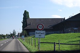
Geltwil
| Geltwil | ||
|---|---|---|
 |
||
|
||
| Coordinates: 47°15′N 8°20′E / 47.250°N 8.333°ECoordinates: 47°15′N 8°20′E / 47.250°N 8.333°E | ||
| Country | Switzerland | |
| Canton | Aargau | |
| District | Muri | |
| Area | ||
| • Total | 3.3 km2 (1.3 sq mi) | |
| Elevation | 681 m (2,234 ft) | |
| Population (Dec 2015) | ||
| • Total | 201 | |
| • Density | 61/km2 (160/sq mi) | |
| Postal code | 5637 | |
| SFOS number | 4232 | |
| Surrounded by | Beinwil (Freiamt), Benzenschwil, Buttwil, Muri, Müswangen (LU) | |
| Website |
www SFSO statistics |
|
Geltwil is a municipality in the district of Muri in the canton of Aargau in Switzerland.
The earliest trace of human settlement near Geltwil is a Roman era villa. The modern municipality of Geltwil is first mentioned in 1160 as Geltwile. The history of Geltwil was always closely connected with Muri Abbey. In the 13th Century the main part of the land was given by Habsburgs to the Abbey. Even after the conquest of the Aargau in 1415 the village belonged the Muri district.
Geltwil is also part of the Muri parish. Between 1798-1803, Geltwil, Isenbergschwil and Winterschwil formed a collective community. In 1816, a reorganization of the district of Muri, led to creation of today's community.
With a nearly constant population, Geltwil has remained a purely farming village. In the center is the school house was built in 1972 and the memorial to the battle that took place during the Sonderbund war in Geltwil in 1847. In 1942, the municipality refused to bow to Axis pressure and introduce Daylight saving time.
Geltwil has an area, as of 2009[update], of 3.3 square kilometers (1.3 sq mi). Of this area, 2.65 km2 (1.02 sq mi) or 80.3% is used for agricultural purposes, while 0.5 km2 (0.19 sq mi) or 15.2% is forested. Of the rest of the land, 0.16 km2 (0.062 sq mi) or 4.8% is settled (buildings or roads).
Of the built up area, housing and buildings made up 2.4% and transportation infrastructure made up 2.4%. Out of the forested land, 13.6% of the total land area is heavily forested and 1.5% is covered with orchards or small clusters of trees. Of the agricultural land, 48.8% is used for growing crops and 28.8% is pastures, while 2.7% is used for orchards or vine crops.
The municipality is located in the Muri district on the eastern slope of the Lindenberg. It consists of the villages of Geltwil and Isenbergschwil.
...
Wikipedia


