Gareloi Volcano
| Gareloi Volcano | |
|---|---|

Summit of the volcano
|
|
| Highest point | |
| Elevation | 5,161 ft (1,573 m) |
| Prominence | 5,161 ft (1,573 m) |
| Listing |
|
| Coordinates | 51°47′18″N 178°47′39″W / 51.78833°N 178.79417°WCoordinates: 51°47′18″N 178°47′39″W / 51.78833°N 178.79417°W |
| Geography | |
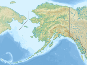
| Location | Gareloi Island, Alaska, U.S. |
| Parent range | Aleutian Islands |
| Geology | |
| Age of rock | Holocene- |
| Mountain type | Stratovolcano |
| Volcanic arc/belt | Aleutian Arc |
| Last eruption | August 1989 |
The Gareloi Volcano is a stratovolcano in the Aleutian Islands of Alaska, United States, about 1,259 miles (2,026 km) from Anchorage. Gareloi is located on Gareloi Island, and comprises most of its land mass. The island also has two small glaciers which protrude to the northwest and southeast.
The volcano is 6 miles (10 km) by 5 miles (8 km) at its base, possessing two summits. The southern crater is far greater in size, 984 feet (300 m) wide with fumaroles, which can be attributed to edifice failure in the southern wall, while Gareloi's northern crater is enclosed.
Vitus Bering had been a prominent sailor in Russia. After successful expeditions in 1725, 1728, and 1730, Bering was sent to explore what is now the Bering Sea area of the Pacific in 1740. He soon settled on Kamchatka, where he started a settlement and built two additional vessels, dubbed St. Peter and St. Paul. In 1741 Bering and his company started towards North America, but were stalled by a storm and in being delayed were forced to take land. During the storm they could not make out the Alaskan coast. The storm proved too powerful so the ships turned around, along the way charting several of the Aleutians, including Gareloi. Since then, it has been barely studied, resulting in a fragmentary knowledge of its eruptions and possibly even unrecorded episodes.
Gareloi Island is uninhabited and is part of the Alaska Maritime National Wildlife Refuge managed by the U.S. Fish and Wildlife Service.
Gareloi is the northernmost volcano of the Delarof Group, a subgroup of the Aleutian Islands. It is composed of two craters, the older of which is covered by lava flows running to the northwest and southern coasts. The northern crater is small, with a feature suggesting dome collapse in its northwest flank. The southern flank, higher up and considerably larger, contains fumarolic activity. A fissure created by Gareloi's 1929 eruption runs along the southern summit of the volcano. Steep sea cliffs on the southwest side of the island cut into the older caldera. Three masses offshore of the island were produced by debris flows from the volcano.
...
Wikipedia

