Garden Home, Oregon
| Garden Home-Whitford, Oregon | |
|---|---|
| CDP | |

Recreation Center in Garden Home
|
|
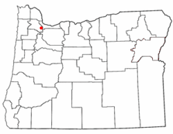
 Location of Garden Home-Whitford, Oregon |
|
| Coordinates: 45°27′50″N 122°45′32″W / 45.46389°N 122.75889°WCoordinates: 45°27′50″N 122°45′32″W / 45.46389°N 122.75889°W | |
| Country | United States |
| State | Oregon |
| County | Washington |
| Area | |
| • Total | 1.9 sq mi (4.9 km2) |
| • Land | 1.9 sq mi (4.9 km2) |
| • Water | 0.0 sq mi (0.0 km2) |
| Elevation | 259 ft (79 m) |
| Population (2010) | |
| • Total | 6,674 |
| • Density | 3,656.9/sq mi (1,411.9/km2) |
| Time zone | Pacific (PST) (UTC-8) |
| • Summer (DST) | PDT (UTC-7) |
| FIPS code | 41-27825 |
Garden Home-Whitford is a census-designated place (CDP) consisting of the neighborhoods of Garden Home and the smaller Whitford area in Washington County, Oregon, United States. They are located in the southwest hills of Portland, near Beaverton. As of the 2000 census, the CDP population was 6,931.
Garden Home post office was established in 1882. Garden Home was an established community when the Oregon Electric Railway was built at the beginning of the 20th century, which named a depot on the line for the community. Whitford was a station on the same line, located at the present-day intersection of Allen Road and Scholls Ferry Road (Oregon Route 210); the name was created by combining the names of W. A. White and A.C. Bedford, New York investors who were directors of the railway.
Whitford station closed when the railway stopped running circa 1920, and unlike Garden Home, which became the name of a Portland suburb, Whitford exists today primarily as the name of a Beaverton middle school.
According to the United States Census Bureau, the CDP has a total area of 1.9 square miles (4.9 km2), all land.
As of the census of 2000, there were 6,931 people, 3,048 households, and 1,834 families residing in the CDP. The population density was 3,656.9 people per square mile (1,408.5/km²). There were 3,175 housing units at an average density of 1,675.2/sq mi (645.2/km²). The racial makeup of the CDP was 91.79% White, 3.17% Asian, 0.75% African American, 0.40% Native American, 0.16% Pacific Islander, 0.72% from other races, and 3.00% from two or more races. Hispanic or Latino of any race were 3.20% of the population.
...
Wikipedia
