Fueguino
| Fueguino | |
|---|---|
| Highest point | |
| Elevation | 150 metres (490 ft) |
| Coordinates | 54°57′S 70°15′W / 54.95°S 70.25°WCoordinates: 54°57′S 70°15′W / 54.95°S 70.25°W |
| Geography | |
| Location |
Cook, Londonderry Island Tierra del Fuego, Magallanes |
| Parent range | Tierra del Fuego |
| Geology | |
| Age of rock | Miocene-Holocene |
| Mountain type | Volcanic field |
| Volcanic belt | Austral Volcanic Zone |
| Last eruption | 1926 |
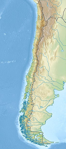
Fueguino is a volcanic field in Chile. The southernmost volcano in the Andes, it lies on Tierra del Fuego's Cook Island and also extends over nearby Londonderry Island. The field is formed by lava domes, pyroclastic cones, and a crater lake.
Volcanic activity at Fueguino is part of the Austral Volcanic Zone, which is formed by the subduction of the Antarctic Plate beneath the South America Plate. The subducting plate has not reached a depth sufficient for proper volcanic arc volcanism, however.
The field bears no trace of glacial erosion on its volcanoes, and reports exist of volcanic activity in 1712, 1820 and 1926.
Cities in the region are Rio Gallegos, Puerto Natales, Punta Arenas, Rio Grande and Ushuaia.
Fueguino is the southernmost volcano in the Andes. The volcano to the north is Monte Burney, which lies 400 kilometres (250 mi) northwest of Fueguino. Both volcanoes belong to the Austral Volcanic Zone. Since the Paleocene, a transform fault, which bisects the island, has been moving the southern part of Tierra del Fuego eastward along the South America Plate, accompanied by tectonic uplift that persisted into the Holocene except when it was offset by glacial loading effects.
...
Wikipedia

