Froyle
| Upper & Lower Froyle | |
|---|---|
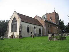
 St Mary's Church, Upper Froyle |
|
| Upper & Lower Froyle shown within Hampshire | |
| OS grid reference | SU759435 |
| Civil parish |
|
| District | |
| Shire county | |
| Region | |
| Country | England |
| Sovereign state | United Kingdom |
| Police | Hampshire |
| Fire | Hampshire |
| Ambulance | South Central |
| EU Parliament | South East England |
| UK Parliament | |
Froyle, or to be more accurate, Upper and Lower Froyle, is a village and civil parish in the East Hampshire district of Hampshire, England. It is 3.6 miles (5.8 km) northeast of Alton, just off the A31 road.
The nearest railway station is Bentley, 2 miles (3.3 km) east of the village.
Froyle is situated on the edge of The Downs above the Pilgrims' Way that leads from Winchester to Canterbury. It is most likely that, in the winter months, the actual route taken by Pilgrims passed through the village to avoid the wet conditions in the valley of the River Wey. There was a Church at "Froli" (mentioned in the Domesday Book) in 1086. The entry for Froyle also states "Froyle, it was ever there...." and there are traces of habitation on the surrounding downs going back to the Iron Age.
It is also known by some who live there as the 'village of the saints' because of the 19 statues of saints in niches on the front walls of houses and other buildings in Upper Froyle. They were bought by Sir Hubert Miller in the early 20th century from Italy.
...
Wikipedia

