Friendship Heights, Maryland
| Friendship Village, Maryland | |
|---|---|
| census-designated place | |
 |
|
| Coordinates: 38°57′45″N 77°5′25″W / 38.96250°N 77.09028°WCoordinates: 38°57′45″N 77°5′25″W / 38.96250°N 77.09028°W | |
| Country | |
| State |
|
| County |
|
| Area | |
| • Total | 0.055 sq mi (0.143 km2) |
| • Land | 0.055 sq mi (0.143 km2) |
| • Water | 0.0 sq mi (0.0 km2) |
| Elevation | 305 ft (93 m) |
| Population (2000) | |
| • Total | 4,512 |
| • Density | 81,992/sq mi (31,657/km2) |
| Time zone | Eastern (EST) (UTC-5) |
| • Summer (DST) | EDT (UTC-4) |
| FIPS code | 24-30837 |
| GNIS feature ID | 1852591 |
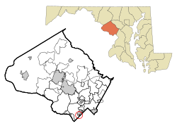
Friendship Village is an unincorporated area in Montgomery County, Maryland, United States. Inclusive within the Friendship Village CDP is the Village of Friendship Heights. (See also: Friendship Heights.) The population was 4,512 at the 2000 census.
As an unincorporated area, Friendship Village's boundaries are not officially defined. Friendship Village is, however, recognized by the United States Census Bureau as a census-designated place, and by the United States Geological Survey as a populated place located at 38°57′45″N 77°5′25″W / 38.96250°N 77.09028°W (38.962510, -77.090181).
According to the United States Census Bureau, the place has a total area of 0.05503 square miles (0.1425 km2), all of it land.
As of the census of 2000, there were 4,512 people, 2,995 households, and 1,003 families residing in the area. The population density was 81,992/sq mi (31,657/km²): this is the highest population density of any incorporated or census-designated place in the United States. There were 3,189 housing units at an average density of 57,950/sq mi (20,521/km²).
The racial makeup of the area was 83.91% White, 4.52% African American, 0.11% Native American, 8.09% Asian, 0.02% Pacific Islander, 0.95% from other races, and 2.39% from two or more races. Hispanic or Latino of any race were 7.96% of the population.
...
Wikipedia
