Friendship (Pittsburgh)
| Friendship | |
|---|---|
| Neighborhood of Pittsburgh | |
 |
|
 |
|
| Coordinates: 40°27′43″N 79°56′02″W / 40.462°N 79.934°W | |
| Country | United States |
| State | Pennsylvania |
| County | Allegheny County |
| City | Pittsburgh |
| Area | |
| • Total | 0.106 sq mi (0.27 km2) |
| Population (2010) | |
| • Total | 1,785 |
| • Density | 17,000/sq mi (6,500/km2) |
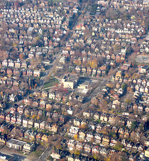
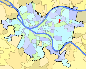
Friendship is a neighborhood of large Victorian houses in the East End of the City of Pittsburgh, Pennsylvania, United States, about four miles (6 km) east of Pittsburgh's Golden Triangle. Friendship is bordered on the north by Garfield (at Penn Avenue), on the east by East Liberty (at Negley Avenue), on the south by Shadyside (at Centre Avenue), and on the west by Bloomfield (at Gross St). It is divided into 3 Pittsburgh City Council districts (7, 8, & 9).
Just before the American Revolution, early settler Casper Taub claimed Friendship, along with neighboring Bloomfield and Garfield, from the native Delaware tribe. In 1762, British Colonel Henry Bouquet recognized Taub's title to the land in exchange for Taub's promise to sell crops to the British garrison at Fort Pitt.
Taub's daughter Elizabeth married Joseph Conrad Winebiddle, a German immigrant who moved to Lawrenceville in 1771, founded a tannery, and used the profits to buy Taub's land. Winebiddle's holdings then passed to his four children. One daughter, Kitty Winebiddle, inherited what constitutes Friendship today. Many of the streets in the area take their names from members of the Winebiddle clan, including Winebiddle, Roup (Kitty Winebiddle married a John Roup), Aiken, Negley, and Baum.
The City of Pittsburgh annexed the East End in 1868, and the Winebiddle clan began dividing their land into plots and selling them. What is now Bloomfield was developed first and was divided into narrow plots and used for rowhouses. The Roup holdings—today's Friendship—began to be developed later, when trolleys running along Baum Boulevard extended beyond Bloomfield in the 1890s.
...
Wikipedia
