Freetown-Fall River State Forest
| Freetown-Fall River State Forest | |
| Massachusetts State Forest | |
|
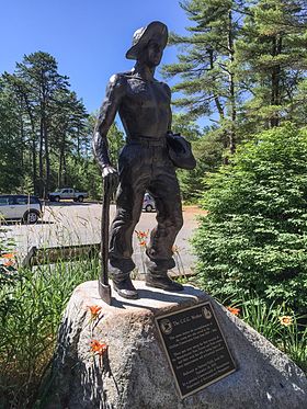
Statue of the C.C.C. Worker
|
|
| Nickname: Freetown State Forest | |
| Country | United States |
|---|---|
| State | Massachusetts |
| Counties | Bristol, Plymouth |
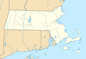
| Municipalities | Freetown, Fall River, Lakeville |
| Elevation | 207 ft (63 m) |
| Coordinates | 41°45′28″N 71°03′48″W / 41.75778°N 71.06333°WCoordinates: 41°45′28″N 71°03′48″W / 41.75778°N 71.06333°W |
| Area | 5,217 acres (2,111 ha) |
| Established | 1913 |
| Management | Massachusetts Department of Conservation and Recreation |
| - location | Slab Bridge Road, Assonet |
| - coordinates | 41°46′45″N 71°02′31″W / 41.77917°N 71.04194°W |
| Website: Freetown-Fall River State Forest | |
The Freetown-Fall River State Forest (commonly shortened to Freetown State Forest) is a publicly owned forest covering more than 5,000 acres (2,000 ha) in the city of Fall River and the towns of Freetown and Lakeville in the state of Massachusetts. The forest lies mostly in the center of the town of Freetown (about a third of the town) dividing Assonet, East Freetown, and Fall River's northern most boundary. The forest land includes Profile Rock, a granite outcropping which local Native Americans believe to be the image of Chief Massasoit, and a 227-acre (92 ha) Wampanoag reservation. The forest is owned by the Commonwealth of Massachusetts and operated by the Department of Conservation and Recreation with headquarters in Assonet.
The state first acquired land in Assonet for forest purposes in 1913, purchasing approximately nine acres on Forge Pond from Levi Churchill of Berkley. The majority of the land was acquired over twenty years beginning in the 1930s. The Civilian Conservation Corps worked on the property from 1935 to 1937. A statue was dedicated in honor of the program and its efforts in the forest in September, 2002.
Recent additions to the forest have included 87 acres (2012), 29 acres (2015), and 77 acres (2015) in Assonet and 613 acres (2015) in Lakeville.
The forest has more than 50 miles (80 km) of unpaved roads and trails for walking, hiking, biking, cross-country skiing, dog sledding, off-road vehicle, and equestrian use. A picnic area with wading pool, playing fields and restrooms is located near the main entrance. Rattlesnake Brook is stocked with brook trout in spring. Hunting is available on a restricted basis.
...
Wikipedia


