Franklin Square (Philadelphia)
|
Franklin Square
|
|

The Fountain is at the center of the park; the carousel can be seen on the left (2013)
|
|
| Location | Race, N. 6th and N. 7th Streets Philadelphia, Pennsylvania |
|---|---|
| Coordinates | 39°57′19.83″N 75°9′2.84″W / 39.9555083°N 75.1507889°WCoordinates: 39°57′19.83″N 75°9′2.84″W / 39.9555083°N 75.1507889°W |
| Area | 7.5 acres (3.0 ha) |
| Built | 1683 |
| Architect | Thomas Holme |
| Website | http://historicphiladelphia.org/franklin-square/what-to-see/ |
| MPS | Four Public Squares of Philadelphia TR |
| NRHP Reference # | 81000556 |
| Added to NRHP | September 14, 1981 |
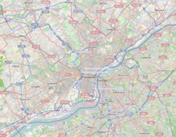
Franklin Square is one of the five original open-space parks planned by William Penn when he laid out the city of Philadelphia, Pennsylvania in 1682. It is located in the Center City area, between North 6th and 7th Streets, and between Race Street and the Vine Street Expressway (I-676).
The park went through a period of deterioration, but was refurbished and revitalized in 2006. It is now managed by Historic Philadelphia, a non-profit organization.
Franklin Square was added to the National Register of Historic Places (NRHP) in 1981.
Originally called North East Publick Square, Franklin Square was renamed in 1825 to honor Benjamin Franklin, one of the Founding Fathers of the United States. In its early years, the square was an open common used for grazing animals, storing gunpowder during the American Revolution and drilling soldiers during the War of 1812. From 1741 to 1835, a portion of the Square was used as a cemetery by the German Reformed Church; some of the graves still remain, marked by a plaque.
In the 19th and early 20th centuries, Franklin Square was at the center of a fashionable residential neighborhood; but beginning in the 1920s, a series of events corresponding with the rise of the automobile began the decline of the Square and its surrounding neighborhood. The construction of the Ben Franklin Bridge, from 1922–26, leveled blocks of row homes, shops and other structures; the Bridge begins at the Square’s eastern boundary, 6th Street. The steady flow of cars over the bridge made Franklin Square’s northern boundary, Vine Street, into one of the city’s busiest thoroughfares, effectively cutting off pedestrian access on two of the Square's sides.
...
Wikipedia


