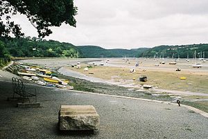
Fowey estuary
| River Fowey | |
|---|---|

River Fowey at Golant
|
|

The course of the River Fowey and neighbouring rivers in Cornwall
|
|
| Basin features | |
| Main source |
Bodmin Moor 298 m (978 ft) |
| River mouth |
Fowey estuary 50°19′40″N 4°38′30″W / 50.32778°N 4.64167°WCoordinates: 50°19′40″N 4°38′30″W / 50.32778°N 4.64167°W |
The River Fowey (![]() i/ˈfɔɪ/ FOY; Cornish: Fowi) is a river in Cornwall, England, United Kingdom.
i/ˈfɔɪ/ FOY; Cornish: Fowi) is a river in Cornwall, England, United Kingdom.
It rises at Fowey Well (originally Cornish: Fenten Fowi, meaning spring of the river Fowey) about 1-mile (1.6 km) north-west of Brown Willy on Bodmin Moor, not far from one of its tributaries rising at Dozmary Pool and Colliford Lake, passes Lanhydrock House, Restormel Castle and Lostwithiel, then broadens at Milltown before joining the English Channel at Fowey. The estuary is called Uzell (Cornish: Usel, meaning howling place). It is only navigable by larger craft for the last 7 miles (11 km). There is a ferry between Fowey and Bodinnick. The first road crossing going upstream is in Lostwithiel. The river has seven tributaries, the largest being the River Lerryn. The section of the Fowey Valley between Doublebois and Bodmin Parkway railway station is known as the Glynn Valley (Cornish: Glyn, meaning deep wooded valley). The valley is the route of both the A38 trunk road and the railway line (built by the Cornwall Railway in 1859). The railway line is carried on eight stone viaducts along this stretch (see Cornwall Railway viaducts).
...
Wikipedia
