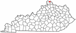
Fort Wright, Kentucky
| Fort Wright, Kentucky | |
|---|---|
| City | |
 Location of Fort Wright, Kentucky |
|
| Coordinates: 39°3′4″N 84°32′6″W / 39.05111°N 84.53500°WCoordinates: 39°3′4″N 84°32′6″W / 39.05111°N 84.53500°W | |
| Country | United States |
| State | Kentucky |
| County | Kenton |
| Area | |
| • Total | 3.5 sq mi (9.0 km2) |
| • Land | 3.5 sq mi (9.0 km2) |
| • Water | 0.0 sq mi (0.0 km2) |
| Elevation | 846 ft (258 m) |
| Population (2000) | |
| • Total | 5,681 |
| • Density | 1,642.1/sq mi (634.0/km2) |
| Time zone | Eastern (EST) (UTC-5) |
| • Summer (DST) | EDT (UTC-4) |
| ZIP codes | 41011, 41017 |
| Area code(s) | 859 |
| FIPS code | 21-28612 |
| GNIS feature ID | 0492358 |
Fort Wright is a home rule-class city in Kenton County, Kentucky, in the United States. The population was 5,723 at the 2010 census.
Fort Wright is located at 39°3′4″N 84°32′6″W / 39.05111°N 84.53500°W (39.051011, -84.535042).
According to the United States Census Bureau, the city has a total area of 3.5 square miles (9.1 km2) of which 3.5 square miles (9.1 km2) is land and 0.29% is water.
The area that is now Fort Wright was the site of one of the American Civil War fortifications built for the Defense of Cincinnati. The city, incorporated in 1941, was named for Major General Horatio Gouverneur Wright, a Union Army engineer.
It annexed the neighboring communities of Lookout Heights in 1937, South Hills in 1949 and Lakeview in 1960.
At the 2000 census, there were 5,681 people, 2,430 households and 1,569 families residing in the city. The population density was 1,642.1 per square mile (633.9/km²). There were 2,573 housing units at an average density of 743.7 per square mile (287.1/km²). The racial makeup of the city was 97.32% White, 0.99% African American, 0.05% Native American, 0.79% Asian, 0.02% Pacific Islander, 0.21% from other races, and 0.62% from two or more races. Hispanic or Latino of any race were 0.69% of the population.
...
Wikipedia
