Fort Elson
| Fort Elson | |
|---|---|
| Type | Palmerston Fort |
| Location | Gosport |
| Coordinates | 50°49′22″N 1°09′03″W / 50.8229°N 1.1509°W |
| OS grid reference | SU 59902 02893 |
| Area | Hampshire |
| Built | 1855–1860 |
| Architect | William Crossman |
| Owner | Ministry of Defence |
| Official name: Fort Elson, Gosport | |
| Reference no. | 1001841 |
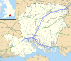
Fort Elson was one of the early Palmerston Forts, in Gosport, England, the northernmost polygonal land fort in the defence line to the west of Gosport. It was located on land immediately to the south of Elson Creek, to which it was connected by a sluice. Fort Elson was the most northerly fort in the line of five which formed part of the ‘Sea Front and Spithead Defences’, Inner Line, Land Front, Left Flank. This line of forts was later known as the Gomer-Elson Line or 'Gosport Advanced Line' This consisted of, from south to north, Fort Gomer, Fort Grange, Fort Rowner, Fort Brockhurst and Fort Elson. Work began on Fort Elson in 1855. The estimated cost of Fort Elson was £63,740 with the actual cost £61,180.
Fort Elson was commenced in 1855 and completed in 1860. Fort Elson was already in existence when the Royal Commission on the Defence of the United Kingdom decided to complete the line of fortifications to the west of Gosport inner defences so technically it is neither a Palmerston Fort nor a Royal Commission Fort. The Commission decided to incorporate Fort Elson and Fort Gomer into the defences by adding three identical forts between them to form the Gosport Advanced Line. The method of construction was to build brick arches, similar to a railway viaduct, forming the main ramparts and then to pour earth on top allowing this to fall back through the arches, allowing it to be carried away a returned to the top once more, until the whole of the scarp rested upon their ends and the parapet was supported by the arches. This method was known as 'escarp en décharge'. It proved difficult and during the construction a major portion of the escarp slipped into the ditch during one night.
The fort consists of a D-shaped rampart for the main armament with the rear (or gorge) closed by a barrack block. This is surrounded by a wet ditch, although it proved difficult to retain water in half of this so a sluice was built to connect the northern section to Fareham Creek (part of Portsmouth Harbour). The front face is a short one with two long flanks, all three having earth ramps up which the main armament and supplementary movable armament could be moved into position. The main magazine is beneath the salient of the front face and left flank accessed by a tunnel from the central parade.
...
Wikipedia

