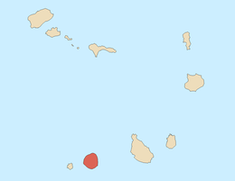
Fogo, Cape Verde
|
Native name: Dja r’ Fogu Nickname: Ilha do vulcão (island of the volcano) |
|
|---|---|
 |
|
| Geography | |
| Location | Atlantic Ocean |
| Coordinates | 14°57′00″N 24°20′33″W / 14.9500°N 24.3425°WCoordinates: 14°57′00″N 24°20′33″W / 14.9500°N 24.3425°W |
| Area | 476 km2 (184 sq mi) |
| Highest elevation | 2,829 m (9,281 ft) |
| Highest point | Pico do Fogo |
| Administration | |
|
Cape Verde
|
|
| Concelhos (Municipalities) | Mosteiros, Santa Catarina do Fogo, São Filipe |
| Largest settlement | São Filipe (pop. Sao Filipe) |
| Demographics | |
| Population | 37,200 |
Fogo (Portuguese for "fire") is the most prominentisland of the Sotavento group of Cape Verde: it rises to nearly 3,000 metres (9,800 feet) above sea level at its summit, Pico do Fogo.
The prehistory of the island had a very large eruption around 73,000 years ago that collapsed the eastern side into the ocean and produced a 170-metre (560-foot) megatsunami that struck Santiago Island. The mountain elevation was between 3,500 and 4,000 metres (11,500 and 13,100 feet) tall.
Fogo was first sighted in 1456 by Vicente Dias along with Alvise Cadamosto and Antoniotto Usodimare, Fogo was fully discovered in 1460 by a Genovese captain António Noli on behalf of Henry the Navigator and the Portuguese Crown, and was first called São Filipe, meaning Saint Philip in Portuguese. It gained its current fiery name before the 1680 eruption, since a madrigal "The Andalusian Merchant" by Thomas Weelkes, who died in 1623, sings "how strangely Fogo burns, amidst an ocean full of flying fishes".
There are now two cities in the island: São Filipe and Mosteiros.
The Portuguese settled the island in 1500. Emigration started in 1850, mainly to North America. The 1910 civil revolution in Portugal drew aristocracy and large land-owners back to Portugal and left civilians behind. A small museum on Fogo explains many of these connections.
Volcanic eruptions have occurred in 1680, 1769, 1785, 1799, 1847, 1852, 1857, 1951, 1995, and 2014. The first eruption was in 1680 in which was the last time it erupted from the top, it devastated much of the island, many inhabitants fled to the nearby island of Brava, the eruption continued for a few years and would act as a natural lighthouse for ships. The black color of the soil from the previous eruptions are still seen today. The 1769 eruption was the last time it erupted from the top of the peak. The 1995 eruption began on April 2–3 and nearby residents were evacuated, it was preceded by small earthquakes which began six days prior to the first eruption lava, it intensified on April 18 with large, explosive bursts, by morning, the activity returned to lava fountaining. In 2014, another eruption occurred from near the same vent as the last, the population was evacuated again, it was slightly greater and much of Portela would be destroyed and much of Bangaeira had suffered minor damages though the lava went to the area, a part of the road was destroyed.
...
Wikipedia

