Fleming-Neon, Kentucky
| Fleming-Neon, Kentucky | |
|---|---|
| City | |
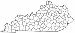
 Location of Fleming-Neon, Kentucky |
|
| Coordinates: 37°11′40″N 82°42′21″W / 37.19444°N 82.70583°WCoordinates: 37°11′40″N 82°42′21″W / 37.19444°N 82.70583°W | |
| Country | United States |
| State | Kentucky |
| County | Letcher |
| Established (merger) | July 7, 1977 |
| Government | |
| • Type | Mayor-Council |
| • Mayor | Susan Polis |
| Area | |
| • Total | 1.7 sq mi (4.3 km2) |
| • Land | 1.7 sq mi (4.3 km2) |
| • Water | 0.0 sq mi (0.0 km2) |
| Elevation | 1,391 ft (424 m) |
| Population (2000) | |
| • Total | 840 |
| • Density | 509.0/sq mi (196.5/km2) |
| Time zone | Eastern (EST) (UTC-5) |
| • Summer (DST) | EDT (UTC-4) |
| ZIP code | 41840 |
| Area code(s) | 606 |
| FIPS code | 21-27846 |
| GNIS feature ID | 1681811 |
Fleming-Neon is a 5th-class city in Letcher County, Kentucky, in the United States. The population was 840 at the 2000 census.
The city was established by the Elkhorn Coal Corporation which moved into the area in 1913. Fleming was the location of the mine and was named for its first president, George W. Fleming. A city named Chip existed near the community that became Fleming; it was quickly built up and served as a trading center for the nearby coal towns. The train that hauled the coal out of Fleming would make stops in Neon. Local tradition holds that the conductor would holler instructions to people climbing aboard the train to "Knee On" and this was corrupted into the present name, replacing Chip. In 1977, the two towns were merged into Fleming-Neon during their municipal incorporation by the state assembly.
Fleming-Neon is located at 37°11′40″N 82°42′21″W / 37.19444°N 82.70583°W (37.194421, -82.705937).
According to the United States Census Bureau, the city has a total area of 1.6 square miles (4.1 km2), all land.
As of the census of 2000, there were 840 people, 351 households, and 244 families residing in the city. The population density was 509.0 people per square mile (196.6/km²). There were 403 housing units at an average density of 244.2 per square mile (94.3/km²). The racial makeup of the city was 96.55% White, 2.86% African American, and 0.60% from two or more races. Hispanic or Latino of any race were 0.60% of the population.
...
Wikipedia
