Fischingen TG
| Fischingen | ||
|---|---|---|

Fischingen village
|
||
|
||
| Coordinates: 47°25′N 8°58′E / 47.417°N 8.967°ECoordinates: 47°25′N 8°58′E / 47.417°N 8.967°E | ||
| Country | Switzerland | |
| Canton | Thurgau | |
| District | Münchwilen | |
| Area | ||
| • Total | 30.62 km2 (11.82 sq mi) | |
| Elevation | 625 m (2,051 ft) | |
| Population (Dec 2016) | ||
| • Total | 2,686 | |
| • Density | 88/km2 (230/sq mi) | |
| Postal code | 8376 | |
| SFOS number | 4726 | |
| Surrounded by | Bichelsee-Balterswil, Eschlikon, Fischenthal (ZH), Kirchberg (SG), Mosnang (SG), Sirnach, Sternenberg (ZH), Turbenthal (ZH), Wila (ZH) | |
| Website |
www SFSO statistics |
|
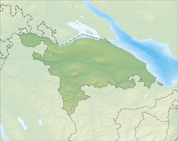
Fischingen is a municipality in the district of Münchwilen in the canton of Thurgau in Switzerland.
Fischingen is first mentioned in 1328 as Fischinon. In 1972, Dussnang, Fischingen, Oberwangen and Tannegg merged with Fischingen.
The village was built north of the twelfth-century Benedictine Fischingen Abbey. It was, together with Bichelsee, Balterswil, Ifwil, and probably Au, part of the old Fischinger court, which opened in 1432. It was closely connected to the Tannegg Amt, which bought the Abbey in 1693.
The Catholic village church was supported by the Abbey, while the Reformed minority belonged to the Dussnang parish. In 1848 the Abbey was closed and the Abbey church became the center of a new, separate parish. The church was located on the way to Einsiedeln and its pilgrimage church, so in 16th and 17th Centuries a small pilgrimage industry grew up in Fischingen. The pilgrimage chapel grew up around the grave of Saint Idda of Toggenburg, who had lived in the Abbey. In the 17th and 18th centuries the premises were rebuilt in the Baroque and Rococo styles. Between 1685 and 1687 a new abbey church was constructed, and in 1705 a new chapel dedicated to Saint Idda. In the 18th century part of the monastic premises was rebuilt, but could not be completed because of the abbey's accumulated debts.
Fischingen has an area, as of 2009[update], of 30.62 square kilometers (11.82 sq mi). Of this area, 14.58 km2 (5.63 sq mi) or 47.6% is used for agricultural purposes, while 14.16 km2 (5.47 sq mi) or 46.2% is forested. Of the rest of the land, 1.79 km2 (0.69 sq mi) or 5.8% is settled (buildings or roads), 0.06 km2 (15 acres) or 0.2% is either rivers or lakes and 0.1 km2 (25 acres) or 0.3% is unproductive land.
...
Wikipedia


