Farallones de Cali
| Farallones de Cali | |
|---|---|
| Highest point | |
| Elevation | 4,050 m (13,290 ft) |
| Coordinates | 03°30′29″N 76°41′45″W / 3.50806°N 76.69583°WCoordinates: 03°30′29″N 76°41′45″W / 3.50806°N 76.69583°W |
| Geography | |
| Country | Colombia |
| PNN Farallones de Cali | |
|---|---|
|
IUCN category II (national park)
|
|

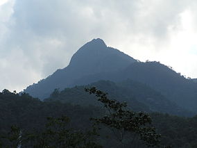
Pico de Loro (Parrot Peak)
|
|
| Nearest city | Cali, Colombia |
| Area | 150,000 ha (580 sq mi) |
| Established | 1968 |
| Governing body | SINAP |
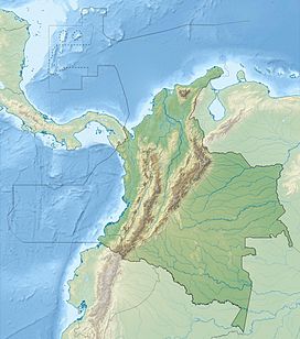
Farallones de Cali is a cluster of mountains in the West Andes of Colombia. It is located west of the city of Cali and gives rise to many of the rivers that provide water and electricity to Cali. The PNN Farallones de Cali encompasses 150,000 ha (580 sq mi) in the mountains as well as much of the Pacific slope and is an area of very high biodiversity.. The average temperature ranges from 25 °C (77 °F) in the tropical foothills to 5 °C (41 °F) in the páramo.
Average yearly rainfall is 6,000 mm (240 in) in the Pacific region and 2,500 mm (98 in) in the mountainous sector. Plants growing in the area have sufficient water throughout the year.
The topography of the park is characterized by the high, craggy peaks, the highest being 4,050 m (13,290 ft). These peaks are referred to as Los Farallones (which means cliffs), the namesake of the mountains and national park. The foothills on the eastern side meet the Cauca Valley and the city of Cali. On the west slope there are numerous river canyons that wind their way toward the Pacific Ocean.
The Farrallones are visible from the city of Cali.
On the east slope the following rivers flow from the Farallones de Cali (from north to south): Cali, Pichindé, Cañaveralejo, Melendez, Lilí, Pance, and Jamundí. These river all flow into the Cauca River.
On the west slope there are many rivers flowing into the Pacific, but the main ones area the Dagua and Anchicayá. There is a hydroelectric dam on the Anchicayá River.
The PNN Farallones de Cali is the largest national park in the Valle del Cauca Department and was formed in 1968. The area is popular for hiking and birdwatching. Access from Cali is by two main routes: by way of the Pance River at the southern end or at the northern end via Peñas Blancas or the Pichindé River. Access to the Anchicayá area is via the town of El Queremal. The lowest altitude of the park is 200 m (660 ft) in the Pacific lowlands.
...
Wikipedia

