Falun, Kansas
| Falun, Kansas | |
|---|---|
| census-designated place | |
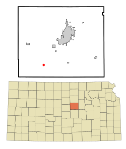
 Location within Saline County and Kansas |
|
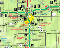
 KDOT map of Saline County (legend) |
|
| Coordinates: 38°40′16″N 97°45′34″W / 38.67111°N 97.75944°WCoordinates: 38°40′16″N 97°45′34″W / 38.67111°N 97.75944°W | |
| Country | United States |
| State | Kansas |
| County | Saline |
| Time zone | Central (CST) (UTC-6) |
| • Summer (DST) | CDT (UTC-5) |
| ZIP codes | 67442 |
Falun is an unincorporated community and census-designated place in southwestern Saline County, Kansas, United States. It lies southwest of the city of Salina, the county seat of Saline County. Its elevation is 1,348 feet (411 m), and it is located at 38°40′16″N 97°45′34″W / 38.67111°N 97.75944°W (38.6711171, -97.7594855). Although it is unincorporated, it has a post office, with the ZIP code of 67442. Falun is part of the Salina Micropolitan Statistical Area.
The first post office in Falun was established in 1870.
Falun is part of Unified School District 400.
...
Wikipedia
