Fairfax, Oklahoma
| Fairfax, Oklahoma | |
|---|---|
| Town | |
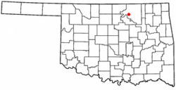
 Location of Fairfax, Oklahoma |
|
| Coordinates: 36°34′17″N 96°42′23″W / 36.57139°N 96.70639°WCoordinates: 36°34′17″N 96°42′23″W / 36.57139°N 96.70639°W | |
| Country | United States |
| State | Oklahoma |
| County | Osage |
| Government | |
| • Mayor | Burley Hathcoat |
| Area | |
| • Total | 0.8 sq mi (2.1 km2) |
| • Land | 0.8 sq mi (2.1 km2) |
| • Water | 0.0 sq mi (0.0 km2) |
| Elevation | 853 ft (260 m) |
| Population (2010) | |
| • Total | 1,380 |
| • Density | 1,947.2/sq mi (751.8/km2) |
| Time zone | Central (CST) (UTC-6) |
| • Summer (DST) | CDT (UTC-5) |
| ZIP code | 74637 |
| Area code(s) | 539/918 |
| FIPS code | 40-24850 |
| GNIS feature ID | 1092690 |
Fairfax is a town in Osage County, Oklahoma, United States. The Osage Nation reservation is co-terminus with the County. The population was 1,380 at the 2010 census, down 11.3 percent from 1,555 at the 2000 census. It is notable as the home of world-famous ballerinas Maria and Marjorie Tallchief.
When the Santa Fe Railway chose to go up Salt Creek valley and bypassed the village of Gray Horse (which continues to exist today as the home of one of the Osage tribe's three major historic bands) the present day town of Fairfax was created. Local merchants, including Lew A. Wismeyer, moved buildings from Gray Horse and leased 40 acres (16 ha) acres for a townsite. Wismeyer rejected the name Coda proposed by the railroad and convinced them to call the depot Fairfax after a hotel he had stayed at in Washington, D.C. The Osage tribe retained title to the townsite until March 3, 1905, when Congress provided for the land to be sold at public auction, with the proceeds credited to the tribe. Fairfax had 470 residents at the time of statehood in 1907.
Fairfax is located at 36°34′17″N 96°42′23″W / 36.57139°N 96.70639°W (36.571386, -96.706259). It is 28 miles (45 km) southwest of Pawhuska and32 miles (51 km) southeast of Ponca City.
According to the United States Census Bureau, the town has a total area of 0.8 square miles (2.1 km2), all of it land.
As of the census of 2000, there were 1,555 people, 657 households, and 417 families residing in the town. The population density was 1,947.2 people per square mile (750.5/km²). There were 831 housing units at an average density of 1,040.6 per square mile (401.1/km²). The racial makeup of the town was 67.65% White, 1.35% African American, 24.12% Native American, 0.19% Asian, 0.45% from other races, and 6.24% from two or more races. Hispanic or Latino of any race were 1.48% of the population.
...
Wikipedia
