Făgăraș Mountains
| Munții Făgăraș | |
|---|---|
| Hungarian: Fogaras hegység | |

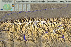
Relief map - Tourist Map
|
|
| Highest point | |
| Peak | Moldoveanu |
| Elevation | 2,544 m (8,346 ft) |
| Geography | |
| Country | Romania |
| Geology | |
| Orogeny | Alpine orogeny |
| Age of rock | Mostly Triassic |
Făgăraș Mountains (Romanian: Munții Făgărașului [ˈmunt͡siː fəɡəˈraʃwlwj], Hungarian: Fogaras hegység [ˈfoɡɒrɒʃ hɛɟˈʃeːɡ]), are the highest mountains of the Southern Carpathians, in Romania. The highest peaks are:
They are bordered in the north by the Făgăraș Depression, through which the Olt river flows, and in the west by the Olt Valley (Valea Oltului). Most people wanting to hike on the Moldoveanu leave from the town of Victoria, in other areas Făgăraș Mountains - Arpasu de Jos, Porumbacu de Jos, Avrig. Despite its name, Făgăraș, located 20 km to the north, is not the nearest town to the mountain range. Other important cities are Brașov and Sibiu.
A road called the Transfăgărășan runs across the Făgăraș Mountains. It is generally open only between June and September, due to unfavorable weather conditions in the rest of the year.
...
Wikipedia
