Eustis, Florida
| Eustis, Florida | |
|---|---|
| City | |

City hall
|
|
| Motto: America's Hometown | |
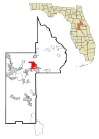
 Location in Lake County and the state of Florida |
|
| Coordinates: 28°51′4″N 81°40′55″W / 28.85111°N 81.68194°WCoordinates: 28°51′4″N 81°40′55″W / 28.85111°N 81.68194°W | |
| Country | |
| State |
|
| County |
|
| Government | |
| • Mayor | Albert Eckian |
| Area | |
| • Total | 9.7 sq mi (24.9 km2) |
| • Land | 8.4 sq mi (21.6 km2) |
| • Water | 1.3 sq mi (3.3 km2) |
| Elevation | 69 ft (21 m) |
| Population (2000) | |
| • Total | 15,106 |
| • Estimate (2014) | 19,098 |
| • Density | 1,600/sq mi (610/km2) |
| Time zone | Eastern (EST) (UTC-5) |
| • Summer (DST) | EDT (UTC-4) |
| ZIP codes | 32726, 32727, 32736 |
| Area code(s) | 352 |
| FIPS code | 12-21350 |
| GNIS feature ID | 0305645 |
| Website | City of Eustis official website |
Eustis is a city in Lake County, Florida, United States. The population was 15,106 at the 2000 census. The Census Bureau estimated the population in 2008 to be 19,129. It is part of the Orlando–Kissimmee–Sanford Metropolitan Statistical Area. Eustis High School is the town's local public high school.
The City of Eustis holds a festival every year which begins on the last Friday of February and runs through Sunday and has been held since 1902. This festival, referred to simply as GeorgeFest, is recognized today as the second longest ongoing annual event held in honor of George Washington, first President of the United States.
Eustis is located at 28°51′04″N 81°40′55″W / 28.850993°N 81.681943°W.
According to the United States Census Bureau, the city has a total area of 9.6 square miles (25 km2), of which 8.4 square miles (22 km2) is land and 1.3 square miles (3.4 km2) (13.28%) is water. The city limits are defined by Eudora, Abrams, and CR 44 (bypass) on the east, CR44 to the north, US Hwy 441 to the south and Lake Eustis and Florida Hospital Waterman to the west.
As of the census of 2000, there were 15,106 people, 6,371 households, and 4,058 families residing in the city. The population density was 1,808.3 inhabitants per square mile (698.5/km²). There were 7,322 housing units at an average density of 876.5 per square mile (338.6/km²). The racial makeup of the city was 76.90% White, 18.98% African American, 0.34% Native American, 0.63% Asian, 0.09% Pacific Islander, 1.89% from other races, and 1.17% from two or more races. Hispanic or Latino of any race were 6.37% of the population.
...
Wikipedia
