Erving, Massachusetts
| Erving, Massachusetts | ||
|---|---|---|
| Town | ||

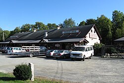
Freight House Antiques
|
||
|
||
 Location in Franklin County in Massachusetts |
||
| Coordinates: 42°36′00″N 72°23′55″W / 42.60000°N 72.39861°WCoordinates: 42°36′00″N 72°23′55″W / 42.60000°N 72.39861°W | ||
| Country | United States | |
| State | Massachusetts | |
| County | Franklin | |
| Settled | 1801 | |
| Incorporated | 1838 | |
| Government | ||
| • Type | Open town meeting | |
| Area | ||
| • Total | 14.4 sq mi (37.3 km2) | |
| • Land | 13.9 sq mi (35.9 km2) | |
| • Water | 0.5 sq mi (1.3 km2) | |
| Elevation | 475 ft (145 m) | |
| Population (2010) | ||
| • Total | 1,800 | |
| • Density | 130/sq mi (48/km2) | |
| Time zone | Eastern (UTC-5) | |
| • Summer (DST) | Eastern (UTC-4) | |
| ZIP code | 01344 | |
| Area code(s) | 413 | |
| FIPS code | 25-21780 | |
| GNIS feature ID | 0618163 | |
| Website | www |
|
Erving is a town in Franklin County, Massachusetts, United States. The population was 1,800 at the 2010 census. It is part of the Springfield, Massachusetts metropolitan statistical area.
Located along the Mohawk Trail, the area was part of the Pocomtuc Indian Nation, whose villages nearby included Squawkeag in what is now Northfield, and Peskeompscut in what is now Turners Falls. Eventually, most of the native population was displaced and/or sold into slavery as a result of King Philip's War and a series of massacres of local Indian villages.
Subsequently, Erving was first settled in 1801 and officially incorporated—it being the last unincorporated land in Massachusetts—in 1838. What is now Erving was once the farm of John Erving, the first colonial in the area. Noted in the 19th century for timber and grazing, the town had seven sawmills, two chair factories, one pail factory, one children's carriage factory, and one bit-brace factory. Large numbers of railroad ties and telegraph poles were cut in the abundant forests here, as many as 1,495,000 in one year. Today, Erving has a school, a police and fire department, public library, several small stores and restaurants.
According to the United States Census Bureau, the town has a total area of 14.4 square miles (37 km2), of which 13.9 square miles (36 km2) is land and 0.5 square miles (1.3 km2) (3.61%) is water. The Millers River, a tributary of the Connecticut River, passes through the town.
...
Wikipedia

