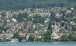
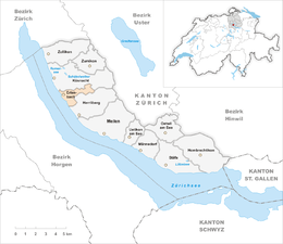
Erlenbach, Zurich
| Erlenbach | ||
|---|---|---|
 |
||
|
||
| Coordinates: 47°18′N 8°35′E / 47.300°N 8.583°ECoordinates: 47°18′N 8°35′E / 47.300°N 8.583°E | ||
| Country | Switzerland | |
| Canton | Zurich | |
| District | Meilen | |
| Area | ||
| • Total | 2.89 km2 (1.12 sq mi) | |
| Elevation | 412 m (1,352 ft) | |
| Population (Dec 2015) | ||
| • Total | 5,472 | |
| • Density | 1,900/km2 (4,900/sq mi) | |
| Postal code | 8703 | |
| SFOS number | 0151 | |
| Surrounded by | Herrliberg, Küsnacht, Thalwil | |
| Twin towns | Erlenbach im Simmental (Switzerland), Erlenbach am Main (Germany) | |
| Website |
www SFSO statistics |
|
![]() Erlenbach is a municipality in the district of Meilen in the canton of Zürich in Switzerland.
Erlenbach is a municipality in the district of Meilen in the canton of Zürich in Switzerland.
Erlenbach is first mentioned in 981 as Liber Heremi though this identification is questionable. Between 1173-90 it was mentioned as Erlibach.
Archeological digs have shown that there were settlements in Erlenbach more than 5,000 years ago. During Roman times an important road passed through what is now Erlenbach. The Alemanni settled in this village in the 6th century. In 981 the name Erlibach was first mentioned when the monastery of Einsiedeln acquired the land. Around 1400 the city of Zürich bought the land. Two castles Balp and Dachsberg are mentioned in old writings, but there is no evidence left.
On 6 October 1445 a small battle (Schlacht bey Ehrlibach) took place in Erlenbach. Troops from Zürich defeated wine thieves. In 1798 the village housed in turn French, Austrian, Russian, and eventually again French troops.
Until the middle of the 19th century, Erlenbach remained a small village with less than 1000 inhabitants, mainly engaged in wine growing. In 1835 the first school was built, but it had just two classrooms.
After World War II the village was very sought after and the population grew dramatically.
Erlenbach has an area of 3 square kilometers (1.2 sq mi). Of this area, 25.7% is used for agricultural purposes, while 26.7% is forested. Of the rest of the land, 47% is settled (buildings or roads) and the remainder (0.7%) is non-productive (rivers, glaciers or mountains). In 1996[update] housing and buildings made up 37% of the total area, while transportation infrastructure made up the rest (10.1%). Of the total unproductive area, water (streams and lakes) made up 0.3% of the area. As of 2007[update] 46.3% of the total municipal area was undergoing some type of construction.
...
Wikipedia


