Epsom, New Hampshire
| Epsom, New Hampshire | ||
|---|---|---|
| Town | ||

Town Hall
|
||
|
||
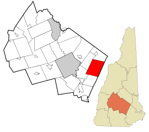
 Location in Merrimack County and the state of New Hampshire |
||
| Coordinates: 43°13′21″N 71°19′57″W / 43.22250°N 71.33250°WCoordinates: 43°13′21″N 71°19′57″W / 43.22250°N 71.33250°W | ||
| Country | United States | |
| State | New Hampshire | |
| County | Merrimack | |
| Incorporated | 1727 | |
| Government | ||
| • Board of Selectmen | Donald Harty, Chair Hugh A. Curley III J. Christopher Bowes |
|
| Area | ||
| • Total | 34.4 sq mi (89.0 km2) | |
| • Land | 34.2 sq mi (88.5 km2) | |
| • Water | 0.2 sq mi (0.5 km2) 0.58% | |
| Elevation | 404 ft (123 m) | |
| Population (2010) | ||
| • Total | 4,566 | |
| • Density | 130/sq mi (51/km2) | |
| Time zone | Eastern (UTC-5) | |
| • Summer (DST) | Eastern (UTC-4) | |
| ZIP code | 03234 | |
| Area code(s) | 603 | |
| FIPS code | 33-24900 | |
| GNIS feature ID | 0873592 | |
| Website | www.epsomnh.org | |
Epsom is a town in Merrimack County, New Hampshire, United States. The population was 4,566 at the 2010 census.
Incorporated in 1727, Epsom takes its name from Epsom in Surrey, England. Although dotted with several small mountains, the land was suitable for grazing and growing grain. By 1859, when the town's population was 1,366, it had two gristmills and two sawmills.
According to the United States Census Bureau, the town has a total area of 34.4 square miles (89 km2), of which 34.2 sq mi (89 km2) is land and 0.2 sq mi (52 ha) is water, comprising 0.58% of the town. The highest point in Epsom is the summit of Fort Mountain, at 1,413 feet (431 m) above sea level, in the eastern part of town. Other neighboring small mountains in town include McCoy Mountain (1,270 ft or 390 m) and Nats Mountain (1,180 ft or 360 m). The town is drained by the Suncook River. Epsom lies fully within the Merrimack River watershed.
As of the census of 2000, there were 4,021 people, 1,491 households, and 1,103 families residing in the town. The population density was 117.7 people per square mile (45.4/km²). There were 1,592 housing units at an average density of 46.6 per square mile (18.0/km²). The racial makeup of the town was 98.63% White, 0.10% African American, 0.10% Native American, 0.32% Asian, 0.10% from other races, and 0.75% from two or more races. Hispanic or Latino of any race were 0.45% of the population.
...
Wikipedia

