Emerald Necklace
| Emerald Necklace | |
|---|---|

Boston Public Garden, the second "jewel" of the Emerald Necklace
|
|
| Type | Public park |
| Location | Boston and Brookline, Massachusetts, United States |
| Created | 1860s |
| Operated by | Emerald Necklace Conservancy |
| Open |
All year |
|
Olmsted Park System
|
|
 |
|
| Location | Boston and Brookline, Massachusetts |
| Coordinates | 42°19′34″N 71°06′52″W / 42.32611°N 71.11444°WCoordinates: 42°19′34″N 71°06′52″W / 42.32611°N 71.11444°W |
| Built | 1870 |
| Architect | Olmsted, Frederick Law, Sr. |
| NRHP Reference # | |
| Added to NRHP | December 8, 1971 |
All year
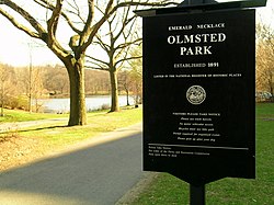
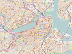
The Emerald Necklace consists of a 1,100-acre (4.5 km2), or 445-hectare chain of parks linked by parkways and waterways in Boston and Brookline, Massachusetts. It gets its name from the way the planned chain appears to hang from the "neck" of the Boston peninsula; to this day it is not fully constructed. In 1989 the Emerald Necklace Parks was designated as Boston Landmark by the Boston Landmarks Commission.
The Necklace comprises half of the City of Boston's park acreage, parkland in the Town of Brookline, and parkways and park edges under the jurisdiction of the Commonwealth of Massachusetts. More than 300,000 people live within its watershed area. From Boston Common to Franklin Park it is approximately seven miles by foot or bicycle through the parks.
The Emerald Necklace includes:
Several components of the Emerald Necklace pre-date the plan to unite them. Some links of the Emerald Necklace not only offer an opportunity for recreation in a wooded environment, but are also ecologically important urban wilds that provide nesting places for migratory birds and improve the air quality of the city.
This linear system of parks was designed by Frederick Law Olmsted to connect Boston Common, dating from the colonial period, and Public Garden (1837) to Franklin Park, known as the "great country park."
The project began around 1878 with the effort to clean up and control the marshy area which became the Back Bay and The Fens. In 1880, Olmsted proposed that the Muddy River, which flowed from Jamaica Pond through the Fens, be included in the park plan. The current was dredged into a winding stream and directed into the Charles River. The corridor encompassing the river became the linear park still in existence today. Olmsted's vision of a linear park of walking paths along a gentle stream connecting numerous small ponds was complete by the turn of the century. The parks conceived by Olmsted, from Storrow Drive south to Franklin Park, were collectively listed on the National Register of Historic Places as the Olmsted Park System.
...
Wikipedia


