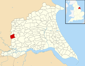
Ellerton and Aughton
| Ellerton and Aughton | |
|---|---|
| Civil parish | |
 |
|
| Coordinates: 53°50.5′N 0°55.5′W / 53.8417°N 0.9250°WCoordinates: 53°50.5′N 0°55.5′W / 53.8417°N 0.9250°W | |
| Country | England |
| Primary council | East Riding of Yorkshire |
| Region | Yorkshire and the Humber |
| Status | Parish |
| Government | |
| • Type | Parish Council |
| • UK Parliament | Haltemprice and Howden |
| • EU Parliament | Yorkshire and the Humber |
| Population (2011 census) | |
| • Total | 388 |
Ellerton and Aughton is a civil parish in the East Riding of Yorkshire, England. It is situated 12 miles (19 km) to the west of Hull city centre and covering an area of 1,824.551 hectares (4,508.56 acres).
The civil parish is formed by the villages of Ellerton and Aughton.
According to the 2011 UK census, Ellerton and Aughton parish had a population of 388, an increase on the 2001 UK census figure of 355.
...
Wikipedia
