Ellendale, Delaware
| Ellendale, Delaware | |
|---|---|
| Town | |

Ellendale Fire Company
|
|
| Nickname(s): The Gateway to Delaware's Resort Beaches | |
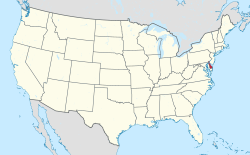
 Location in Sussex County and the state of Delaware. |
|
 |
|
| Coordinates: 38°48′24″N 75°25′26″W / 38.80667°N 75.42389°WCoordinates: 38°48′24″N 75°25′26″W / 38.80667°N 75.42389°W | |
| Country | United States |
| State | Delaware |
| County | Sussex |
| Area | |
| • Total | 0.3 sq mi (0.7 km2) |
| • Land | 0.3 sq mi (0.7 km2) |
| • Water | 0.0 sq mi (0.0 km2) |
| Elevation | 49 ft (15 m) |
| Population (2010) | |
| • Total | 381 |
| • Density | 1,270/sq mi (544.3/km2) |
| Time zone | Eastern (EST) (UTC-5) |
| • Summer (DST) | EDT (UTC-4) |
| ZIP code | 19941 |
| Area code(s) | 302 |
| FIPS code | 10-24020 |
| GNIS feature ID | 0213934 |
Ellendale is a town in Sussex County, Delaware, United States. The population was 381 at the 2010 census, an increase of 16.5% since 2000. It is part of the Salisbury, Maryland-Delaware Metropolitan Statistical Area. Ellendale is the "Gateway to Delaware's Resort Beaches" because it is the town located on U.S. Highway 113, the resort area's western most border, and Delaware Route 16, the resort area's northern most border with the eastern border being the Delaware Bay and Atlantic Ocean and the southern border being the state line with Maryland. Ellendale is home to the Philadelphia Bible College and the Harbor Christian Academy.
Ellendale started as a forest and swamp on the divide between the Chesapeake Bay and Delaware Bay. The swamp was the hunting grounds of the Nanticoke Indian Tribe until they were driven out by the Lenni Lenape Tribe on the Battle Green near Chestnut Ridge, a hill on Ellendale's north side. The Lenape Trace, a main thoroughfare of a trail, passed through Ellendale as a Native American trade route from Pocomoke City, Maryland to Marcus Hook, Pennsylvania. With the arrival of Europeans, the Ellendale area was a province of fur traders and hunters. Early in the 18th century, farming and timbering pushed back the swamp that once covered the area. The tract of land on which the town would later be built was originally deeded in 1740 as "Bennett's Pleasure".
The "Nanticoke Swamp," as the Ellendale Swamp was then called, was depicted as a place where criminals routinely hid from the law in the depositions of a 1759 murder that occurred. One of the main causes being the issue of jurisdiction as both Maryland and Delaware were in a boundary dispute and claimed the area. The Ellendale Swamp became a refuge for Loyalists at the time of the 1780 Black Camp Insurrection during the American Revolution. Harold Hancock describes the insurrection in his History of Sussex County: "With the removal of the British from Philadelphia in the spring of 1778, the number of enemy vessels in Delaware Bay decreased, and the activities of Sussex County Tories diminished. Only one other insurrection in Sussex County occurred – the famous Black Camp Rebellion of 1780. The insurrectionists were mainly from Cedar Creek and Slaughter Neck Hundred, and their headquarters were in a swamp about six miles (10 km) north of Georgetown. Their leaders, Bartholomew Banynum (Banum) and William Dutton, had about 400 men formed in “Associations” or militia companies. An investigator reported the causes as follows: ‘Some of these ignorant people were for opposing all law, others for establishing what they called the King’s Laws – and others for opposing the payment of taxes – but generally seem to have believed that all to the southward of Chesapeak Bay had laid down their arms and submitted to the King’s Laws – and that they should very easy make Sussex County do the same.’
...
Wikipedia
