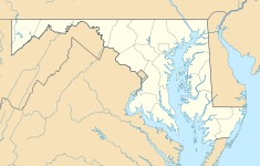
Elkridge Landing
| Elkridge Landing | |
|---|---|

Elkridge Main Street
|
|
| Location | Elkridge, Maryland |
| Coordinates | 39°12′58.09″N 76°42′33.22″W / 39.2161361°N 76.7092278°W |
| Area | 100 acres |
| Founded | 1690 |
| Official name: Elkridge Landing Historic District | |
| Designated | 2003 |
| Reference no. | HO-784 |
Elkridge Landing was a Patapsco River seaport in Maryland, and is now part of Elkridge, Maryland. The historic Elkridge Furnace Inn site resides within the Patapsco Valley State Park.
It is in present-day Howard County, Maryland, west of the Patapsco River, south of Route 1 and with the Baltimore and Ohio Railroad (B and O Railroad) running through the middle of the historic district. The historic roads are the old Washington Turnpike, now Main Street, Railroad Avenue, Paradise Avenue, Elkridge Heights Road and Furnace Avenue.
Pottery has been found dating back to 1800 B.C.E. and there is evidence of settlement along the Patapsco River until 1500 C.E..
In 1690 the town and seaport of Elkridge Landing was settled in the Patapsco Valley of the Colony of Maryland. It was a deep-water port, with a channel about 10 feet deep, that brought ships inland from the Chesapeake Bay. Tobacco casks, or hogsheads, were rolled down Rolling Hill to the port by "long strings of slaves" and boarded ships. Manufactured iron was also shipped out of the port.
Native Americans lived north of the Elkridge Landing site in 1692 and rangers were appointed among the settlers to keep watch.
Around 1725 a 28 by 16 foot "Rowling House" with clapboard siding was built on the landing to store tobacco rolled in hogsheads to market. In 1727, the state ended the practice of having ship sailors personally retrieve hogsheads of tobacco themselves. Inland tobacco farms were able to increase productivity by rolling their own hogsheads to ports of Baltimore, Annapolis and Elkridge. Six acres around the Rowling house were surveyed by William Cromwell on 7 February 1743. The site was purchased by Caleb and Edward Dorsey and named "Calebs and Edwards Friendship".
...
Wikipedia

