Elk Creek (Rogue River)
| Elk Creek | |
|
An aerial view of the notched Elk Creek Dam in July 2010
|
|
| Country | United States |
|---|---|
| State | Oregon |
| County | Jackson |
| Source | Cascade Range |
| - location | Rogue River–Siskiyou National Forest, Jackson County, Oregon |
| - elevation | 4,931 ft (1,503 m) |
| - coordinates | 42°53′07″N 122°35′34″W / 42.88528°N 122.59278°W |
| Mouth | Rogue River |
| - location | near Rogue Elk, between Lost Creek Lake and Trail, Jackson County, Oregon |
| - elevation | 1,460 ft (445 m) |
| - coordinates | 42°39′44″N 122°45′20″W / 42.66222°N 122.75556°WCoordinates: 42°39′44″N 122°45′20″W / 42.66222°N 122.75556°W |
| Length | 18 mi (29 km) |
| Discharge | for 1.5 miles (2.4 km) from the mouth |
| - average | 214 cu ft/s (6 m3/s) |
| - max | 19,200 cu ft/s (544 m3/s) |
| - min | 0.01 cu ft/s (0 m3/s) |
|
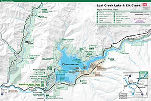
Recreation map of the Elk Creek and Lost Creek Lake areas managed by the U. S. Army Corps of Engineers along the Rogue River in southern Oregon
|
|
Elk Creek is an 18-mile (29 km) tributary of the Rogue River in the U.S. state of Oregon. Beginning at 4,931 feet (1,503 m) above sea level in the western foothills of the Cascade Range, it flows generally southwest through the Rogue River – Siskiyou National Forest and the U.S. Army Corps of Engineers Elk Creek Project lands to Rogue Elk Park in Jackson County. Here the creek enters the Rogue River 5.25 miles (8.45 km) downstream from Lost Creek Lake and 3.2 miles (5.1 km) river miles upstream of the small town of Trail. Elk Creek Dam, an incomplete flood-control structure that blocked fish migration for more than 20 years, was partly demolished in 2008 to restore endangered anadromous fish passage.
In its first 6 miles (10 km) or so, Elk Creek receives Brush Creek from the , Swanson and Bitter Lick creeks from the , and Button Creek from the left. From here to the creek mouth, Elk Creek Road runs parallel to the stream along its right bank. Thereafter, Dodes Creek enters from the left and Sugarpine, Jones, Shell, and Flat creeks from the right. Near river mile (RM) 7 or river kilometer (RK) 11, Middle Creek enters from the right, and shortly thereafter Alco Creek also enters from the right. Elk Creek receives West Branch Elk Creek from the right about 3 miles (5 km) from the mouth, slightly upstream of the Elk Creek Dam. Below the dam, the creek passes a United States Geological Survey (USGS) stream gauge, which is on the right at RM 1.3 (RK 2.1). Shortly thereafter, Berry Creek enters from the right. The creek then passes Rogue Elk County Park, which is on the left, flows under Crater Lake Highway / Oregon Route 62, and enters the Rogue River 152 miles (245 km) from its mouth on the Pacific Ocean.
...
Wikipedia


