Electoral district of Dunstan
|
Dunstan South Australia—House of Assembly |
|
|---|---|

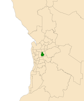
Electoral district of Dunstan (green) in the Greater Adelaide area
|
|
| State | South Australia |
| Created | 2014 |
| MP | Steven Marshall |
| Party | Liberal Party of Australia (SA) |
| Namesake | Don Dunstan |
| Electors | 24,581 (2014) |
| Area | 14.6 km2 (5.6 sq mi) |
| Demographic | Metropolitan |
| Coordinates | 34°54′5″S 138°38′8″E / 34.90139°S 138.63556°ECoordinates: 34°54′5″S 138°38′8″E / 34.90139°S 138.63556°E |
Dunstan is an electoral district of the House of Assembly in the Australian state of South Australia, covering the inner eastern suburbs of Beulah Park, College Park, Evandale, Firle, Hackney, Joslin, Kensington, Kent Town, Marden, Maylands, Norwood, Payneham South, Royston Park, St Morris, St Peters, Stepney, Trinity Gardens and Vale Park and parts of Klemzig and Payneham.
The electorate was created in a 2012 redistribution of electoral boundaries. It was essentially a reconfigured version of Norwood, with electoral boundaries remaining unchanged. It is named after the 35th Premier of South Australia Don Dunstan, who represented Norwood for Labor from 1953 to 1979. As of the 2010 election it was the first time that Labor was in government without holding Norwood.
...
Wikipedia
