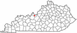
Ekron, Kentucky
| Ekron, Kentucky | |
|---|---|
| City | |
 Location of Ekron, Kentucky |
|
| Coordinates: 37°55′51″N 86°10′41″W / 37.93083°N 86.17806°WCoordinates: 37°55′51″N 86°10′41″W / 37.93083°N 86.17806°W | |
| Country | United States |
| State | Kentucky |
| County | Meade |
| Area | |
| • Total | 0.1 sq mi (0.3 km2) |
| • Land | 0.1 sq mi (0.3 km2) |
| • Water | 0.0 sq mi (0.0 km2) |
| Elevation | 656 ft (200 m) |
| Population (2000) | |
| • Total | 170 |
| • Density | 1,498.8/sq mi (578.7/km2) |
| Time zone | Eastern (EST) (UTC-5) |
| • Summer (DST) | EDT (UTC-4) |
| ZIP code | 40117 |
| Area code(s) | 270 & 364 |
| FIPS code | 21-24094 |
| GNIS feature ID | 0491600 |
Ekron is a home rule-class city in Meade County, Kentucky, United States. The population was 170 at the 2000 census.
Ekron is located at 37°55′51″N 86°10′41″W / 37.93083°N 86.17806°W (37.930819, -86.177999).
According to the United States Census Bureau, the city has a total area of 0.1 square miles (0.26 km2), all land.
Ekron was laid out on land donated by a Dr. Roberts, whose wife named the town after the biblical city Ekron. It was formally incorporated by act of the state assembly in 1906.
As of the census of 2000, there were 170 people, 65 households, and 44 families residing in the city. The population density was 1,498.8 people per square mile (596.7/km²). There were 69 housing units at an average density of 608.3 per square mile (242.2/km²). The racial makeup of the city was 88.24% White, 1.76% African American, 0.59% Native American, 1.76% Asian, 2.94% from other races, and 4.71% from two or more races. Hispanic or Latino of any race were 2.94% of the population.
...
Wikipedia
