Easton, New Hampshire
| Easton, New Hampshire | |
|---|---|
| Town | |

Town center
|
|
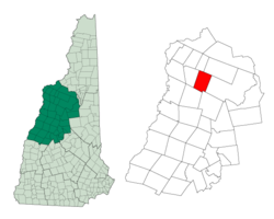
 Location in Grafton County, New Hampshire |
|
| Coordinates: 44°08′46″N 71°47′24″W / 44.14611°N 71.79000°WCoordinates: 44°08′46″N 71°47′24″W / 44.14611°N 71.79000°W | |
| Country | United States |
| State | New Hampshire |
| County | Grafton |
| Incorporated | 1876 |
| Government | |
| • Board of Selectmen | Ned Cutler, Chair Zak Mei Debbie Stever |
| Area | |
| • Total | 31.2 sq mi (80.8 km2) |
| • Land | 31.2 sq mi (80.8 km2) |
| • Water | 0.0 sq mi (0.0 km2) 0.03% |
| Elevation | 1,167 ft (356 m) |
| Population (2010) | |
| • Total | 254 |
| • Density | 8.1/sq mi (3.1/km2) |
| Time zone | Eastern (UTC-5) |
| • Summer (DST) | Eastern (UTC-4) |
| Area code(s) | 603 |
| FIPS code | 33-22020 |
| GNIS feature ID | 0873586 |
| Website | www |
Easton is a town in Grafton County, New Hampshire, United States. The population was 254 at the 2010 census.
Formed from a part of Landaff known as Eastern Landaff, Easton was incorporated in 1876.
Kinsman Mountain, the Kinsman Range, and Kinsman Notch are named for Asa Kinsman, one of the original settlers.
According to the United States Census Bureau, the town has a total area of 31.2 square miles (81 km2), of which 0.03% is water. The highest point in Easton is 4,040 feet (1,230 m) above sea level, just west of the 4,293-foot (1,309 m) summit of the North Peak of Kinsman Mountain. The Wild Ammonoosuc River drains the southern part of town, while the Ham Branch of the Gale River drains the northern portion and passes the town's village. Easton lies fully within the Connecticut River watershed.
As of the census of 2000, there were 256 people, 117 households, and 84 families residing in the town. The population density was 8.2 people per square mile (3.2/km²). There were 187 housing units at an average density of 6.0 per square mile (2.3/km²). The racial makeup of the town was 96.48% White, 0.78% Native American, and 2.73% from two or more races. Hispanic or Latino of any race were 0.78% of the population.
...
Wikipedia
