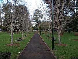
East Toowoomba, Queensland
|
East Toowoomba Toowoomba, Queensland |
|||||||||||||||
|---|---|---|---|---|---|---|---|---|---|---|---|---|---|---|---|

|
|||||||||||||||
| Coordinates | 27°33′43″S 151°58′8″E / 27.56194°S 151.96889°ECoordinates: 27°33′43″S 151°58′8″E / 27.56194°S 151.96889°E | ||||||||||||||
| Population | 5,676 (2011 census) | ||||||||||||||
| • Density | 1,351/km2 (3,500/sq mi) | ||||||||||||||
| Postcode(s) | 4350 | ||||||||||||||
| Area | 4.2 km2 (1.6 sq mi) | ||||||||||||||
| Location | 2 km (1 mi) E of Toowoomba | ||||||||||||||
| LGA(s) | Toowoomba Region | ||||||||||||||
| State electorate(s) | Toowoomba North | ||||||||||||||
| Federal Division(s) | Groom | ||||||||||||||
|
|||||||||||||||
East Toowoomba is a locality in the Toowoomba Region, Queensland, Australia. At the 2011 Australian Census East Toowoomba recorded a population of 5,675.
East Toowomba is2 kilometres (1 mi) from the Toowoomba central business district. The east and south of the suburb is crossed by the Warrego Highway.
The suburb contains the main Bridge Street campus of Southern Queensland Institute of TAFE, and two elite independent schools, Toowoomba Grammar School (boys) and Fairholme College (girls).
In addition, the suburb contains Toowoomba Preparatory School, Toowoomba East State School (1887) and Mater Dei Primary School (Catholic, 1917).
Toowoomba East State School is Toowoomba's largest primary school with 950 students attending.
There are a number of heritage-listed sites in East Toowoomba, including:
...
Wikipedia

